

ANS-55km
A cycling route starting in Balcones Heights, Texas, United States.
Overview
About this route
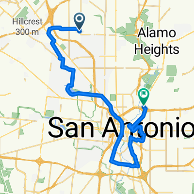
Ride around San Antoio from Marriott Hotel: 55km
- -:--
- Duration
- 55.5 km
- Distance
- 260 m
- Ascent
- 252 m
- Descent
- ---
- Avg. speed
- ---
- Max. altitude
Route quality
Waytypes & surfaces along the route
Waytypes
Busy road
18.8 km
(34 %)
Road
14.3 km
(26 %)
Surfaces
Paved
30.3 km
(55 %)
Asphalt
26.4 km
(48 %)
Concrete
3.6 km
(7 %)
Continue with Bikemap
Use, edit, or download this cycling route
You would like to ride ANS-55km or customize it for your own trip? Here is what you can do with this Bikemap route:
Free features
- Save this route as favorite or in collections
- Copy & plan your own version of this route
- Sync your route with Garmin or Wahoo
Premium features
Free trial for 3 days, or one-time payment. More about Bikemap Premium.
- Navigate this route on iOS & Android
- Export a GPX / KML file of this route
- Create your custom printout (try it for free)
- Download this route for offline navigation
Discover more Premium features.
Get Bikemap PremiumFrom our community
Other popular routes starting in Balcones Heights
 hankie problems
- Distance
- 21.2 km
- Ascent
- 217 m
- Descent
- 264 m
- Location
- Balcones Heights, Texas, United States
 ANS-55km
- Distance
- 55.5 km
- Ascent
- 260 m
- Descent
- 252 m
- Location
- Balcones Heights, Texas, United States
 my work
- Distance
- 6.4 km
- Ascent
- 107 m
- Descent
- 31 m
- Location
- Balcones Heights, Texas, United States
 De U.S. 87 Bus 8726, San Antonio a Fredericksburg Road 9400, San Antonio
- Distance
- 10.4 km
- Ascent
- 69 m
- Descent
- 78 m
- Location
- Balcones Heights, Texas, United States
 Esmeralda Drive 245, San Antonio to East Turbo Drive 118E, San Antonio
- Distance
- 20 km
- Ascent
- 145 m
- Descent
- 100 m
- Location
- Balcones Heights, Texas, United States
 creek to la b
- Distance
- 20.6 km
- Ascent
- 221 m
- Descent
- 223 m
- Location
- Balcones Heights, Texas, United States
 Lengthy Evening Course In San Antonio
- Distance
- 25.3 km
- Ascent
- 0 m
- Descent
- 0 m
- Location
- Balcones Heights, Texas, United States
 bike tour through San Antonio
- Distance
- 27.9 km
- Ascent
- 64 m
- Descent
- 94 m
- Location
- Balcones Heights, Texas, United States
Open it in the app