

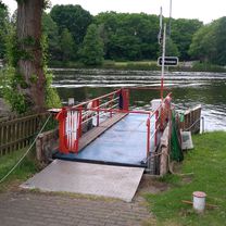
Rund um den Schwielochsee
A cycling route starting in Friedland, Brandenburg, Germany.
Overview
About this route
Day trip with swimming opportunities
(cloned from route 2256192)
- -:--
- Duration
- 41.1 km
- Distance
- 123 m
- Ascent
- 123 m
- Descent
- ---
- Avg. speed
- ---
- Max. altitude
Continue with Bikemap
Use, edit, or download this cycling route
You would like to ride Rund um den Schwielochsee or customize it for your own trip? Here is what you can do with this Bikemap route:
Free features
- Save this route as favorite or in collections
- Copy & plan your own version of this route
- Sync your route with Garmin or Wahoo
Premium features
Free trial for 3 days, or one-time payment. More about Bikemap Premium.
- Navigate this route on iOS & Android
- Export a GPX / KML file of this route
- Create your custom printout (try it for free)
- Download this route for offline navigation
Discover more Premium features.
Get Bikemap PremiumFrom our community
Other popular routes starting in Friedland
 Schwielochsee Teil2 (Leißnitz-Fähre bis Wiese)
- Distance
- 31.5 km
- Ascent
- 167 m
- Descent
- 163 m
- Location
- Friedland, Brandenburg, Germany
 Leißnitz 32A nach Leißnitz 32A
- Distance
- 105.7 km
- Ascent
- 447 m
- Descent
- 446 m
- Location
- Friedland, Brandenburg, Germany
 Rund um den Schwielochsee
- Distance
- 41.1 km
- Ascent
- 115 m
- Descent
- 115 m
- Location
- Friedland, Brandenburg, Germany
 Rund um den Schwielochsee
- Distance
- 41.1 km
- Ascent
- 118 m
- Descent
- 118 m
- Location
- Friedland, Brandenburg, Germany
 Fähre Leißnitz Jänschwalde Ost
- Distance
- 50 km
- Ascent
- 185 m
- Descent
- 142 m
- Location
- Friedland, Brandenburg, Germany
 Klein Rondje Schwielochsee 48 km
- Distance
- 47.3 km
- Ascent
- 138 m
- Descent
- 136 m
- Location
- Friedland, Brandenburg, Germany
 Rund um den Schwielochsee
- Distance
- 41.1 km
- Ascent
- 123 m
- Descent
- 123 m
- Location
- Friedland, Brandenburg, Germany
 Leißn-Fähr-Treb-Goyatz-Fried-Leiß-Ende
- Distance
- 39.9 km
- Ascent
- 138 m
- Descent
- 137 m
- Location
- Friedland, Brandenburg, Germany
Open it in the app