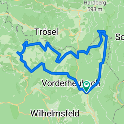
Altneudorf - Eichköpfl über Eiterbach
A cycling route starting in Heiligkreuzsteinach, Baden-Wurttemberg, Germany.
Overview
About this route
Alternative für 1. Mai
- -:--
- Duration
- 18.7 km
- Distance
- 430 m
- Ascent
- 222 m
- Descent
- ---
- Avg. speed
- ---
- Max. altitude
Route quality
Waytypes & surfaces along the route
Waytypes
Track
14.6 km
(78 %)
Road
1.7 km
(9 %)
Surfaces
Paved
5.6 km
(30 %)
Unpaved
12.5 km
(67 %)
Gravel
11.1 km
(60 %)
Asphalt
5.4 km
(29 %)
Continue with Bikemap
Use, edit, or download this cycling route
You would like to ride Altneudorf - Eichköpfl über Eiterbach or customize it for your own trip? Here is what you can do with this Bikemap route:
Free features
- Save this route as favorite or in collections
- Copy & plan your own version of this route
- Sync your route with Garmin or Wahoo
Premium features
Free trial for 3 days, or one-time payment. More about Bikemap Premium.
- Navigate this route on iOS & Android
- Export a GPX / KML file of this route
- Create your custom printout (try it for free)
- Download this route for offline navigation
Discover more Premium features.
Get Bikemap PremiumFrom our community
Other popular routes starting in Heiligkreuzsteinach
- Altneudorf - Eichköpfl über Eiterbach
- Distance
- 18.7 km
- Ascent
- 430 m
- Descent
- 222 m
- Location
- Heiligkreuzsteinach, Baden-Wurttemberg, Germany
- Heiligkreuzsteinach-Bad Wimpfen-Heiligkreuzsteinach
- Distance
- 106.7 km
- Ascent
- 965 m
- Descent
- 965 m
- Location
- Heiligkreuzsteinach, Baden-Wurttemberg, Germany
- AN Eiterbach Siedelsbrunn AN
- Distance
- 24.2 km
- Ascent
- 371 m
- Descent
- 364 m
- Location
- Heiligkreuzsteinach, Baden-Wurttemberg, Germany
- Heilig†steinach - Bad Wimpfen - Dilsberg
- Distance
- 124.5 km
- Ascent
- 863 m
- Descent
- 868 m
- Location
- Heiligkreuzsteinach, Baden-Wurttemberg, Germany
- Heiligkreuzsteinach-Speyer-Heiligkreuzsteinach
- Distance
- 119.4 km
- Ascent
- 731 m
- Descent
- 731 m
- Location
- Heiligkreuzsteinach, Baden-Wurttemberg, Germany
- An Neckarsteinach Burgen Neckargemünd Rainbach Neckarsteinach An
- Distance
- 25.4 km
- Ascent
- 265 m
- Descent
- 228 m
- Location
- Heiligkreuzsteinach, Baden-Wurttemberg, Germany
- Eiterbachtal-Tour
- Distance
- 29.7 km
- Ascent
- 890 m
- Descent
- 885 m
- Location
- Heiligkreuzsteinach, Baden-Wurttemberg, Germany
- am Neckar
- Distance
- 88.4 km
- Ascent
- 703 m
- Descent
- 703 m
- Location
- Heiligkreuzsteinach, Baden-Wurttemberg, Germany
Open it in the app