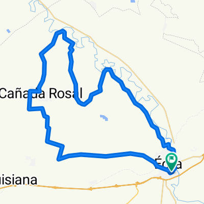
Etapa 26/04/2015
A cycling route starting in Écija, Andalusia, Spain.
Overview
About this route
ECIJA-CAMINO SANTAELLA-AVE-GUIJARRILLO-(REAGRUP)-LA MEMBRILLA-CERRO LA TORRE-LA GUIJARROSA-(AVITUALL)-VEREDA SEVILLA-VEREDA LA RAMBLA-CAÑADA REAL MORO-VIA VERDE-ECIJA
- -:--
- Duration
- 59.7 km
- Distance
- 398 m
- Ascent
- 399 m
- Descent
- ---
- Avg. speed
- ---
- Max. altitude
Route highlights
Points of interest along the route
Point of interest after 21.4 km
Cortijo del Guijarrillo. Reagrupamiento.
Point of interest after 23.5 km
Este camino también lleva al Cortijo de la Membrilla Alta.
Point of interest after 27.3 km
Cortijo de la Membrilla
Point of interest after 28.4 km
Cortijo de la Membrilla Alta
Point of interest after 29.4 km
Cerro de la Torre
Point of interest after 31.2 km
La Guijarrosa. Avituallamiento.
Point of interest after 37.1 km
Cortijo de la Culebrilla.
Point of interest after 37.6 km
Cortijo de Benefique.
Continue with Bikemap
Use, edit, or download this cycling route
You would like to ride Etapa 26/04/2015 or customize it for your own trip? Here is what you can do with this Bikemap route:
Free features
- Save this route as favorite or in collections
- Copy & plan your own version of this route
- Sync your route with Garmin or Wahoo
Premium features
Free trial for 3 days, or one-time payment. More about Bikemap Premium.
- Navigate this route on iOS & Android
- Export a GPX / KML file of this route
- Create your custom printout (try it for free)
- Download this route for offline navigation
Discover more Premium features.
Get Bikemap PremiumFrom our community
Other popular routes starting in Écija
- 4 ETAPA BTT CCCS2017
- Distance
- 55.5 km
- Ascent
- 375 m
- Descent
- 372 m
- Location
- Écija, Andalusia, Spain
- 7 ETAPA BTT CCCS2018 (PREVIA RUTA DEL CALOR)
- Distance
- 81.6 km
- Ascent
- 326 m
- Descent
- 335 m
- Location
- Écija, Andalusia, Spain
- CX 26 MAR 2016
- Distance
- 61.8 km
- Ascent
- 307 m
- Descent
- 304 m
- Location
- Écija, Andalusia, Spain
- RECORRIDO CALOR 2018
- Distance
- 101.2 km
- Ascent
- 571 m
- Descent
- 570 m
- Location
- Écija, Andalusia, Spain
- GRV03
- Distance
- 69.3 km
- Ascent
- 587 m
- Descent
- 594 m
- Location
- Écija, Andalusia, Spain
- 12 CARRETERA CCCS2018
- Distance
- 92.5 km
- Ascent
- 803 m
- Descent
- 802 m
- Location
- Écija, Andalusia, Spain
- Ruta del lagarto 2016
- Distance
- 73.2 km
- Ascent
- 306 m
- Descent
- 306 m
- Location
- Écija, Andalusia, Spain
- 11 CARRETERA CCCS'17
- Distance
- 91.3 km
- Ascent
- 621 m
- Descent
- 623 m
- Location
- Écija, Andalusia, Spain
Open it in the app