

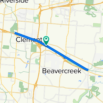
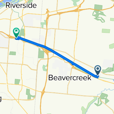
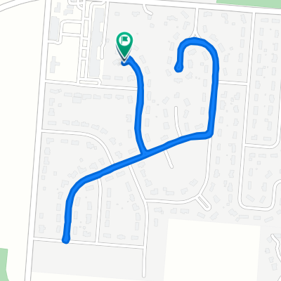
RFW Flat Bikepath
A cycling route starting in Beavercreek, Ohio, United States.
Overview
About this route
Leave Dayton and spend as much distance as posible on the east side bike paths. Results in a very flat, fast route
(cloned from route 52507)
- -:--
- Duration
- 46.9 km
- Distance
- 145 m
- Ascent
- 161 m
- Descent
- ---
- Avg. speed
- ---
- Max. altitude
Route quality
Waytypes & surfaces along the route
Waytypes
Cycleway
23.4 km
(50 %)
Road
7.5 km
(16 %)
Surfaces
Paved
0.5 km
(1 %)
Unpaved
0.9 km
(2 %)
Gravel
0.9 km
(2 %)
Asphalt
0.5 km
(1 %)
Undefined
45.5 km
(97 %)
Continue with Bikemap
Use, edit, or download this cycling route
You would like to ride RFW Flat Bikepath or customize it for your own trip? Here is what you can do with this Bikemap route:
Free features
- Save this route as favorite or in collections
- Copy & plan your own version of this route
- Sync your route with Garmin or Wahoo
Premium features
Free trial for 3 days, or one-time payment. More about Bikemap Premium.
- Navigate this route on iOS & Android
- Export a GPX / KML file of this route
- Create your custom printout (try it for free)
- Download this route for offline navigation
Discover more Premium features.
Get Bikemap PremiumFrom our community
Other popular routes starting in Beavercreek
 Creekside Trail, Beavercreek to Creekside Trail, Beavercreek
- Distance
- 18.5 km
- Ascent
- 59 m
- Descent
- 58 m
- Location
- Beavercreek, Ohio, United States
 800 Factory Rd, Beavercreek to 3623 Linden Ave, Dayton
- Distance
- 10.2 km
- Ascent
- 45 m
- Descent
- 25 m
- Location
- Beavercreek, Ohio, United States
 Sporty route in Beavercreek
- Distance
- 39.1 km
- Ascent
- 152 m
- Descent
- 154 m
- Location
- Beavercreek, Ohio, United States
 RFW - Oakwood Hills
- Distance
- 32.1 km
- Ascent
- 168 m
- Descent
- 174 m
- Location
- Beavercreek, Ohio, United States
 Oxford Craziness
- Distance
- 81.2 km
- Ascent
- 277 m
- Descent
- 283 m
- Location
- Beavercreek, Ohio, United States
 1854–1898 Spaulding Rd, Kettering to 2001–2157 Wilmington Pike, Kettering
- Distance
- 18.2 km
- Ascent
- 123 m
- Descent
- 97 m
- Location
- Beavercreek, Ohio, United States
 RFW Flat Bikepath
- Distance
- 46.8 km
- Ascent
- 126 m
- Descent
- 119 m
- Location
- Beavercreek, Ohio, United States
 1170 Rosendale Dr, Beavercreek to 1170 Rosendale Dr, Beavercreek
- Distance
- 2.8 km
- Ascent
- 0 m
- Descent
- 0 m
- Location
- Beavercreek, Ohio, United States
Open it in the app