

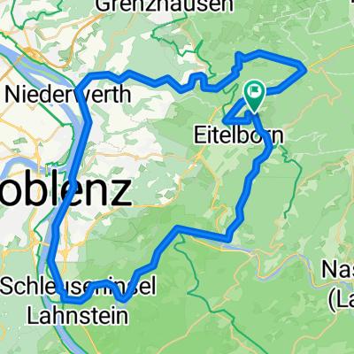
Neuhäusel-Ems-Lahnstein-Mühlental-Neuhäusel
A cycling route starting in Kadenbach, Rhineland-Palatinate, Germany.
Overview
About this route
None (cloned from route 85926)
- -:--
- Duration
- 38.8 km
- Distance
- 377 m
- Ascent
- 377 m
- Descent
- ---
- Avg. speed
- ---
- Max. altitude
Route quality
Waytypes & surfaces along the route
Waytypes
Road
15.1 km
(39 %)
Busy road
11.9 km
(31 %)
Surfaces
Paved
27.9 km
(72 %)
Unpaved
1.1 km
(3 %)
Asphalt
27.4 km
(71 %)
Gravel
0.9 km
(2 %)
Continue with Bikemap
Use, edit, or download this cycling route
You would like to ride Neuhäusel-Ems-Lahnstein-Mühlental-Neuhäusel or customize it for your own trip? Here is what you can do with this Bikemap route:
Free features
- Save this route as favorite or in collections
- Copy & plan your own version of this route
- Sync your route with Garmin or Wahoo
Premium features
Free trial for 3 days, or one-time payment. More about Bikemap Premium.
- Navigate this route on iOS & Android
- Export a GPX / KML file of this route
- Create your custom printout (try it for free)
- Download this route for offline navigation
Discover more Premium features.
Get Bikemap PremiumFrom our community
Other popular routes starting in Kadenbach
 Neuhäusel-Ems-Lahnstein-Mühlental-Neuhäusel
- Distance
- 38.7 km
- Ascent
- 554 m
- Descent
- 490 m
- Location
- Kadenbach, Rhineland-Palatinate, Germany
 Eitelborn - Hillscheid - Höhr - Grenzhausen und zurück
- Distance
- 28.4 km
- Ascent
- 535 m
- Descent
- 497 m
- Location
- Kadenbach, Rhineland-Palatinate, Germany
 20150131_112554.gpx
- Distance
- 10 km
- Ascent
- 115 m
- Descent
- 240 m
- Location
- Kadenbach, Rhineland-Palatinate, Germany
 In der Eck 19, Kadenbach nach Koblenz Hbf
- Distance
- 13.8 km
- Ascent
- 424 m
- Descent
- 573 m
- Location
- Kadenbach, Rhineland-Palatinate, Germany
 Kadenbach - Ko 90k
- Distance
- 90 km
- Ascent
- 958 m
- Descent
- 963 m
- Location
- Kadenbach, Rhineland-Palatinate, Germany
 Neuhäusel - Arzbach über B49 zurück
- Distance
- 15.6 km
- Ascent
- 299 m
- Descent
- 216 m
- Location
- Kadenbach, Rhineland-Palatinate, Germany
 Kadenbach,Bad Ems,Lahnstein,Hillscheid
- Distance
- 48.9 km
- Ascent
- 682 m
- Descent
- 584 m
- Location
- Kadenbach, Rhineland-Palatinate, Germany
 Köppelroute
- Distance
- 19 km
- Ascent
- 396 m
- Descent
- 405 m
- Location
- Kadenbach, Rhineland-Palatinate, Germany
Open it in the app