Rund um Island
- 2,203.7 km
- 1,038 m
- 1,050 m
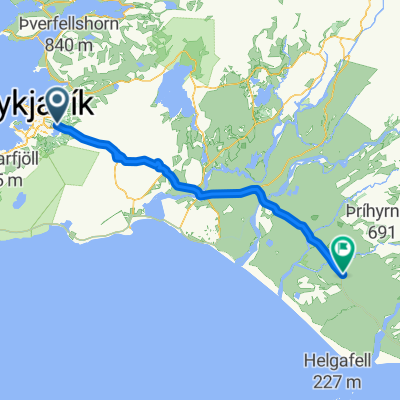
- Kopavogur, Capital Region, Iceland
A cycling route starting in Kopavogur, Capital Region, Iceland.
Overview
tandem route
created this 10 years ago
Route highlights
W centrum znajduje się bardzo przyjemny camping (1100/os, wifi, kuchnia pod wiatą i prysznice w cenie). Kończący podróż zostawiają w kuchni nie zużyte butle z gazem, więc można się za darmo w nie zaopatrzyć. W miasteczku jest supermarket Bonus. 58 km z rejkiawik
tu jest supermarket
Seljalandsfoss
supermarket
Continue with Bikemap
You would like to ride islandia szlak or customize it for your own trip? Here is what you can do with this Bikemap route:
Free trial for 3 days, or one-time payment. More about Bikemap Premium.
Discover more Premium features.
Get Bikemap PremiumFrom our community
Open it in the app