

MTB rondje Breda
A cycling route starting in Hoge Vucht, North Brabant, The Netherlands.
Overview
About this route
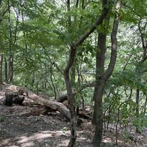
Rondje op de MTB langs Markkanaal, Vrachelse Heide, Kadettenkamp en Dorst
- -:--
- Duration
- 50.3 km
- Distance
- 74 m
- Ascent
- 76 m
- Descent
- ---
- Avg. speed
- ---
- Max. altitude

Continue with Bikemap
Use, edit, or download this cycling route
You would like to ride MTB rondje Breda or customize it for your own trip? Here is what you can do with this Bikemap route:
Free features
- Save this route as favorite or in collections
- Copy & plan your own version of this route
- Sync your route with Garmin or Wahoo
Premium features
Free trial for 3 days, or one-time payment. More about Bikemap Premium.
- Navigate this route on iOS & Android
- Export a GPX / KML file of this route
- Create your custom printout (try it for free)
- Download this route for offline navigation
Discover more Premium features.
Get Bikemap PremiumFrom our community
Other popular routes starting in Hoge Vucht
 Oosterhout-Teteringen-Breda
- Distance
- 20 km
- Ascent
- 23 m
- Descent
- 24 m
- Location
- Hoge Vucht, North Brabant, The Netherlands
 Brusselstraat, Breda do Brusselstraat, Breda
- Distance
- 35.7 km
- Ascent
- 61 m
- Descent
- 61 m
- Location
- Hoge Vucht, North Brabant, The Netherlands
 breda - deinze
- Distance
- 133.8 km
- Ascent
- 202 m
- Descent
- 197 m
- Location
- Hoge Vucht, North Brabant, The Netherlands
 Rondje 7-bergen, Moerdijk, Dimmelen, Breda HB
- Distance
- 62.4 km
- Ascent
- 46 m
- Descent
- 46 m
- Location
- Hoge Vucht, North Brabant, The Netherlands
 Brusselstraat, Breda do Brusselstraat, Breda
- Distance
- 29.1 km
- Ascent
- 20 m
- Descent
- 22 m
- Location
- Hoge Vucht, North Brabant, The Netherlands
 Dorst-Oosterhout-Dongen-Rijen-Dorst 20k
- Distance
- 19.8 km
- Ascent
- 37 m
- Descent
- 35 m
- Location
- Hoge Vucht, North Brabant, The Netherlands
 Short round near Breda and Terheijden
- Distance
- 21 km
- Ascent
- 3 m
- Descent
- 6 m
- Location
- Hoge Vucht, North Brabant, The Netherlands
 Vijf Eiken rondje2
- Distance
- 17.7 km
- Ascent
- 38 m
- Descent
- 36 m
- Location
- Hoge Vucht, North Brabant, The Netherlands
Open it in the app