
Vom Filstal ins Remstal und zurück
A cycling route starting in Wangen, Baden-Wurttemberg, Germany.
Overview
About this route
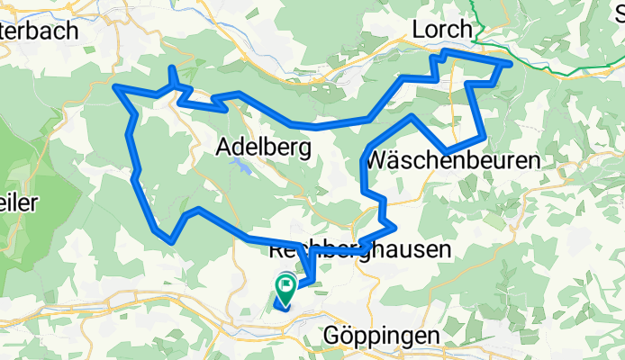
Faurndau - Wangen - Nassachtal - Oberberken - Breech - Unterkirneck - Lorch - Oberkirneck - Wäschenbeuren - Rechberghausen - Faurndau
Challenging MTB route with partially difficult descents.
The route mainly follows forest paths and little-used side roads.
Along the route, there are many beer gardens and other places to stop.
- -:--
- Duration
- 58.6 km
- Distance
- 994 m
- Ascent
- 982 m
- Descent
- ---
- Avg. speed
- 513 m
- Max. altitude
Route quality
Waytypes & surfaces along the route
Waytypes
Track
32.8 km
(56 %)
Quiet road
15.8 km
(27 %)
Surfaces
Paved
27.5 km
(47 %)
Unpaved
25.2 km
(43 %)
Asphalt
22.3 km
(38 %)
Gravel
22.3 km
(38 %)
Continue with Bikemap
Use, edit, or download this cycling route
You would like to ride Vom Filstal ins Remstal und zurück or customize it for your own trip? Here is what you can do with this Bikemap route:
Free features
- Save this route as favorite or in collections
- Copy & plan your own version of this route
- Sync your route with Garmin or Wahoo
Premium features
Free trial for 3 days, or one-time payment. More about Bikemap Premium.
- Navigate this route on iOS & Android
- Export a GPX / KML file of this route
- Create your custom printout (try it for free)
- Download this route for offline navigation
Discover more Premium features.
Get Bikemap PremiumFrom our community
Other popular routes starting in Wangen
 Von Faurndau zurück nach Waiblingen
- Distance
- 30.8 km
- Ascent
- 379 m
- Descent
- 422 m
- Location
- Wangen, Baden-Wurttemberg, Germany
 Goeppingen-Faurndau - Schwaebisch Gmuend CLONED FROM ROUTE 4859
- Distance
- 22.9 km
- Ascent
- 169 m
- Descent
- 149 m
- Location
- Wangen, Baden-Wurttemberg, Germany
 Faurndau-Herlikofen-ret
- Distance
- 73.8 km
- Ascent
- 554 m
- Descent
- 554 m
- Location
- Wangen, Baden-Wurttemberg, Germany
 Owen - Faurndau
- Distance
- 29.1 km
- Ascent
- 279 m
- Descent
- 203 m
- Location
- Wangen, Baden-Wurttemberg, Germany
 Goeppingen-Faurndau - Schwaebisch Gmuend
- Distance
- 22.9 km
- Ascent
- 282 m
- Descent
- 263 m
- Location
- Wangen, Baden-Wurttemberg, Germany
 Auf den Hohenstaufen
- Distance
- 23.1 km
- Ascent
- 584 m
- Descent
- 405 m
- Location
- Wangen, Baden-Wurttemberg, Germany
 30.5.2020 Rundfahrt
- Distance
- 32.3 km
- Ascent
- 569 m
- Descent
- 611 m
- Location
- Wangen, Baden-Wurttemberg, Germany
 GP- Rothenburg o.T.
- Distance
- 116 km
- Ascent
- 767 m
- Descent
- 666 m
- Location
- Wangen, Baden-Wurttemberg, Germany
Open it in the app