

Pleißental und Leinawald
A cycling route starting in Haselbach, Thuringia, Germany.
Overview
About this route
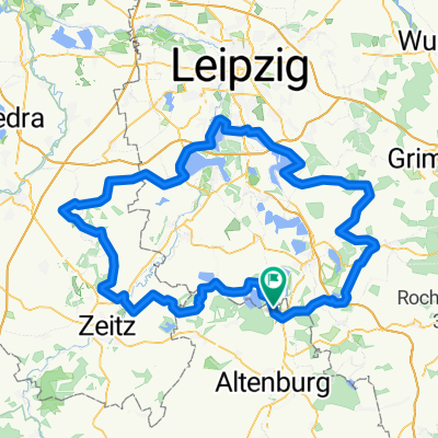
Haselbach, Treben, Windischleuba, Pöppschen, Wilchwitz, Nobitz, Klausa, Leinawald, Dolsenhain, Eschefeld, Pahna, Fockendorf, Treben, Haselbach
- -:--
- Duration
- 44 km
- Distance
- 164 m
- Ascent
- 162 m
- Descent
- ---
- Avg. speed
- ---
- Max. altitude
Route quality
Waytypes & surfaces along the route
Waytypes
Road
18.9 km
(43 %)
Path
5.7 km
(13 %)
Surfaces
Paved
32.5 km
(74 %)
Asphalt
32.5 km
(74 %)
Undefined
11.4 km
(26 %)
Continue with Bikemap
Use, edit, or download this cycling route
You would like to ride Pleißental und Leinawald or customize it for your own trip? Here is what you can do with this Bikemap route:
Free features
- Save this route as favorite or in collections
- Copy & plan your own version of this route
- Sync your route with Garmin or Wahoo
Premium features
Free trial for 3 days, or one-time payment. More about Bikemap Premium.
- Navigate this route on iOS & Android
- Export a GPX / KML file of this route
- Create your custom printout (try it for free)
- Download this route for offline navigation
Discover more Premium features.
Get Bikemap PremiumFrom our community
Other popular routes starting in Haselbach
 Rund um den Haselbacher See
- Distance
- 43 km
- Ascent
- 126 m
- Descent
- 127 m
- Location
- Haselbach, Thuringia, Germany
 Pleißental und Leinawald
- Distance
- 44 km
- Ascent
- 164 m
- Descent
- 162 m
- Location
- Haselbach, Thuringia, Germany
 Frohburg-Waldenburg-Leinawald
- Distance
- 101.9 km
- Ascent
- 537 m
- Descent
- 535 m
- Location
- Haselbach, Thuringia, Germany
 ABG-STL-Gößnitz
- Distance
- 124.9 km
- Ascent
- 785 m
- Descent
- 725 m
- Location
- Haselbach, Thuringia, Germany
 Haselbacher See - Lucka - Großstolpen
- Distance
- 40.8 km
- Ascent
- 123 m
- Descent
- 123 m
- Location
- Haselbach, Thuringia, Germany
 2-Länder CTF, Grenzerfahrung zwischen Thüringen und Sachsen
- Distance
- 20.5 km
- Ascent
- 108 m
- Descent
- 107 m
- Location
- Haselbach, Thuringia, Germany
 Altenburg-Am Stadtwald
- Distance
- 13 km
- Ascent
- 111 m
- Descent
- 48 m
- Location
- Haselbach, Thuringia, Germany
 Hohenmölsen - Markkleeberg - Bad Lausick
- Distance
- 139.7 km
- Ascent
- 241 m
- Descent
- 243 m
- Location
- Haselbach, Thuringia, Germany
Open it in the app