Cara Sur de Gredos. Version 2El
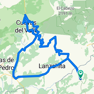
A cycling route starting in Buenaventura, Castille-La Mancha, Spain.
Overview
About this route
Buenaventura, Pedro Bernardo, San Esteban, Santa Cruz, Ramacastañas, Arenas, Guisando, El Hornillo, El Arenal, Cuevas, casi Molbentrán, San Esteban, Pedro Bernardo, Buenaventura
- -:--
- Duration
- 142.5 km
- Distance
- 2,530 m
- Ascent
- 2,530 m
- Descent
- ---
- Avg. speed
- ---
- Avg. speed
Route quality
Waytypes & surfaces along the route
Waytypes
Busy road
79.6 km
(56 %)
Road
38.2 km
(27 %)
Surfaces
Paved
119.4 km
(84 %)
Unpaved
1.9 km
(1 %)
Asphalt
119.3 km
(84 %)
Ground
1.9 km
(1 %)
Continue with Bikemap
Use, edit, or download this cycling route
You would like to ride Cara Sur de Gredos. Version 2El or customize it for your own trip? Here is what you can do with this Bikemap route:
Free features
- Save this route as favorite or in collections
- Copy & plan your own version of this route
- Sync your route with Garmin or Wahoo
Premium features
Free trial for 3 days, or one-time payment. More about Bikemap Premium.
- Navigate this route on iOS & Android
- Export a GPX / KML file of this route
- Create your custom printout (try it for free)
- Download this route for offline navigation
Discover more Premium features.
Get Bikemap PremiumFrom our community
Other popular routes starting in Buenaventura
- Buenaventura-El Sidrillo-Serranillos
- Distance
- 118.4 km
- Ascent
- 2,162 m
- Descent
- 2,160 m
- Location
- Buenaventura, Castille-La Mancha, Spain
- Mijares-Navaquesera-El Pico-Pedro Bernardo
- Distance
- 126.5 km
- Ascent
- 2,482 m
- Descent
- 2,478 m
- Location
- Buenaventura, Castille-La Mancha, Spain
- Buenaventura, El Pico, Mijares
- Distance
- 127.9 km
- Ascent
- 2,276 m
- Descent
- 2,276 m
- Location
- Buenaventura, Castille-La Mancha, Spain
- Pedro Bernardo-Machacona-Centenera-Serranillos-Mijares
- Distance
- 158.1 km
- Ascent
- 3,231 m
- Descent
- 3,231 m
- Location
- Buenaventura, Castille-La Mancha, Spain
- BV-Guisando-Centenera-El Sidrillo-Serranillos-PB
- Distance
- 162.6 km
- Ascent
- 2,460 m
- Descent
- 2,460 m
- Location
- Buenaventura, Castille-La Mancha, Spain
- Buenaventura-Centenera-Mijares
- Distance
- 160.2 km
- Ascent
- 2,621 m
- Descent
- 2,620 m
- Location
- Buenaventura, Castille-La Mancha, Spain
- Buenaventura - Embalse Navalcán
- Distance
- 46.4 km
- Ascent
- 523 m
- Descent
- 582 m
- Location
- Buenaventura, Castille-La Mancha, Spain
- Buenaventura-Guisando-Centenera-Sidrillo-Pedro Bernardo
- Distance
- 111.6 km
- Ascent
- 1,746 m
- Descent
- 1,746 m
- Location
- Buenaventura, Castille-La Mancha, Spain
Open it in the app