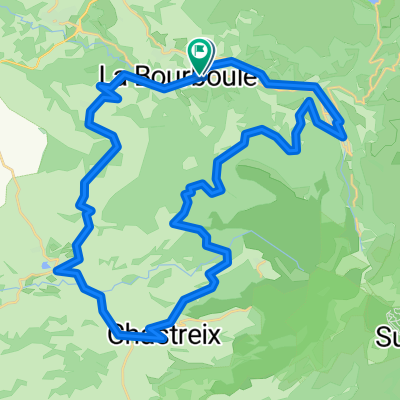
BOURBOULE route des lacs-rochefort en montagne 96km
A cycling route starting in La Bourboule, Auvergne-Rh么ne-Alpes, France.
Overview
About this route
88kms----D茅niv 1890 m----la bourboule - le mont dore - col de la croix st robert - lac chambon - dir murol - 脿 G D5 - lac d'aydat - verneuge - fonclairant - D983 "pr猫s" d'espinasse - fonsalive - vergines - bessat - orcival - st bonnet pr猫s d'orcival - st martin de tours - gioux - rochefort en montagne -聽 col de gu茅ry - lac de gu茅ry - le mont dore - la bourboule
- -:--
- Duration
- 95.3 km
- Distance
- 1,486 m
- Ascent
- 1,487 m
- Descent
- ---
- Avg. speed
- ---
- Avg. speed
Route quality
Waytypes & surfaces along the route
Waytypes
Busy road
49.5 km
(52 %)
Road
31.6 km
(33 %)
Surfaces
Paved
46.2 km
(48 %)
Unpaved
4 km
(4 %)
Asphalt
44.2 km
(46 %)
Gravel
3.2 km
(3 %)
Continue with Bikemap
Use, edit, or download this cycling route
You would like to ride BOURBOULE route des lacs-rochefort en montagne 96km or customize it for your own trip? Here is what you can do with this Bikemap route:
Free features
- Save this route as favorite or in collections
- Copy & plan your own version of this route
- Sync your route with Garmin or Wahoo
Premium features
Free trial for 3 days, or one-time payment. More about Bikemap Premium.
- Navigate this route on iOS & Android
- Export a GPX / KML file of this route
- Create your custom printout (try it for free)
- Download this route for offline navigation
Discover more Premium features.
Get Bikemap PremiumFrom our community
Other popular routes starting in La Bourboule
- BOURBOULE gorges de courgoul 93kms
- Distance
- 91.8 km
- Ascent
- 1,714 m
- Descent
- 1,714 m
- Location
- La Bourboule, Auvergne-Rh么ne-Alpes, France
- 26k MT Dorr茅
- Distance
- 26 km
- Ascent
- 632 m
- Descent
- 643 m
- Location
- La Bourboule, Auvergne-Rh么ne-Alpes, France
- BOURBOULE route des lacs-rochefort en montagne 96km
- Distance
- 95.3 km
- Ascent
- 1,486 m
- Descent
- 1,487 m
- Location
- La Bourboule, Auvergne-Rh么ne-Alpes, France
- bourboule -le mont dore-la croix morand-145km(la uourn茅e)
- Distance
- 144.9 km
- Ascent
- 2,367 m
- Descent
- 2,367 m
- Location
- La Bourboule, Auvergne-Rh么ne-Alpes, France
- BOURBOULE croix st robert-lac pavin-chastrex- 97kms
- Distance
- 96.4 km
- Ascent
- 2,001 m
- Descent
- 1,993 m
- Location
- La Bourboule, Auvergne-Rh么ne-Alpes, France
- 48k Picherande
- Distance
- 47.6 km
- Ascent
- 797 m
- Descent
- 796 m
- Location
- La Bourboule, Auvergne-Rh么ne-Alpes, France
- La Bourboule 60 km 1450 m +
- Distance
- 60 km
- Ascent
- 1,402 m
- Descent
- 1,306 m
- Location
- La Bourboule, Auvergne-Rh么ne-Alpes, France
- bourboule-mont dore- tour d'auvergne-messeix93kms
- Distance
- 93 km
- Ascent
- 1,268 m
- Descent
- 1,268 m
- Location
- La Bourboule, Auvergne-Rh么ne-Alpes, France
Open it in the app