

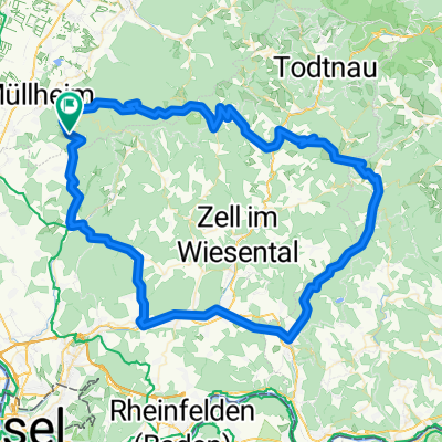
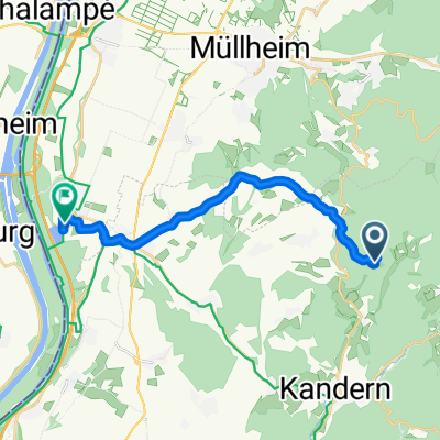
Lipburg - St. Gallenkirch
A cycling route starting in Feldberg, Baden-Württemberg, Germany.
Overview
About this route
Unser Trip ins Montafon
(cloned from route 3002028)
- -:--
- Duration
- 294.7 km
- Distance
- 1,305 m
- Ascent
- 834 m
- Descent
- ---
- Avg. speed
- ---
- Max. altitude
Route quality
Waytypes & surfaces along the route
Waytypes
Quiet road
97 km
(33 %)
Path
55.2 km
(19 %)
Surfaces
Paved
260.5 km
(88 %)
Unpaved
12.1 km
(4 %)
Asphalt
252.5 km
(86 %)
Paved (undefined)
7 km
(2 %)
Continue with Bikemap
Use, edit, or download this cycling route
You would like to ride Lipburg - St. Gallenkirch or customize it for your own trip? Here is what you can do with this Bikemap route:
Free features
- Save this route as favorite or in collections
- Copy & plan your own version of this route
- Split it into stages to create a multi-day tour
- Sync your route with Garmin or Wahoo
Premium features
Free trial for 3 days, or one-time payment. More about Bikemap Premium.
- Navigate this route on iOS & Android
- Export a GPX / KML file of this route
- Create your custom printout (try it for free)
- Download this route for offline navigation
Discover more Premium features.
Get Bikemap PremiumFrom our community
Other popular routes starting in Feldberg
 feldberg nach halden
- Distance
- 34.3 km
- Ascent
- 1,071 m
- Descent
- 294 m
- Location
- Feldberg, Baden-Württemberg, Germany
 Feldberg Bürgeln Blauen
- Distance
- 10.9 km
- Ascent
- 1,227 m
- Descent
- 439 m
- Location
- Feldberg, Baden-Württemberg, Germany
 Über Herrenschwand ins Wehratal
- Distance
- 107.3 km
- Ascent
- 1,916 m
- Descent
- 1,916 m
- Location
- Feldberg, Baden-Württemberg, Germany
 Wehratal
- Distance
- 103.6 km
- Ascent
- 3,385 m
- Descent
- 3,406 m
- Location
- Feldberg, Baden-Württemberg, Germany
 High-speed route in Neuenburg am Rhein
- Distance
- 14.2 km
- Ascent
- 94 m
- Descent
- 471 m
- Location
- Feldberg, Baden-Württemberg, Germany
 Almenweg 2, Müllheim nach Rheintalstraße 4, Müllheim
- Distance
- 22.1 km
- Ascent
- 881 m
- Descent
- 873 m
- Location
- Feldberg, Baden-Württemberg, Germany
 EGGENE1
- Distance
- 57.8 km
- Ascent
- 1,032 m
- Descent
- 1,032 m
- Location
- Feldberg, Baden-Württemberg, Germany
 Um den Belchen
- Distance
- 70.9 km
- Ascent
- 1,446 m
- Descent
- 1,452 m
- Location
- Feldberg, Baden-Württemberg, Germany
Open it in the app