

AA 003: Bad Siess - Tann - Kaseracker - Oberbozen
A cycling route starting in Collalbo, Trentino-Alto Adige, Italy.
Overview
About this route
Wednesday, 22.04.2015:
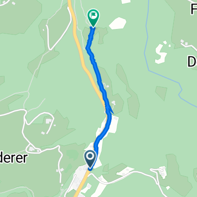
Hotel - 20/Fennpromenade - Lengmoos - 24 - Erdpyramiden - 24A - Gruber - 24A - 24 - Bad Siess - 8 - Tann - 1 - 6 - Riggermoos - 6 - Kaseracker - 6A - Oberbozen - 2 - Bahnhof Oberbozen - 'Bahnle' - Bahnhof Klobenstein - Hotel
- -:--
- Duration
- 12.3 km
- Distance
- 434 m
- Ascent
- 371 m
- Descent
- ---
- Avg. speed
- ---
- Max. altitude
Continue with Bikemap
Use, edit, or download this cycling route
You would like to ride AA 003: Bad Siess - Tann - Kaseracker - Oberbozen or customize it for your own trip? Here is what you can do with this Bikemap route:
Free features
- Save this route as favorite or in collections
- Copy & plan your own version of this route
- Sync your route with Garmin or Wahoo
Premium features
Free trial for 3 days, or one-time payment. More about Bikemap Premium.
- Navigate this route on iOS & Android
- Export a GPX / KML file of this route
- Create your custom printout (try it for free)
- Download this route for offline navigation
Discover more Premium features.
Get Bikemap PremiumFrom our community
Other popular routes starting in Collalbo
 Klobenstein-V
- Distance
- 39.5 km
- Ascent
- 1,275 m
- Descent
- 1,275 m
- Location
- Collalbo, Trentino-Alto Adige, Italy
 Via Plattl 1, Longomoso nach Oberlengmoos 9, Renon
- Distance
- 0.9 km
- Ascent
- 72 m
- Descent
- 57 m
- Location
- Collalbo, Trentino-Alto Adige, Italy
 AA 007: Oberinn
- Distance
- 17.1 km
- Ascent
- 751 m
- Descent
- 685 m
- Location
- Collalbo, Trentino-Alto Adige, Italy
 AA 011: Dolomitenfahrt zur Seiser Alm
- Distance
- 112 km
- Ascent
- 3,204 m
- Descent
- 2,654 m
- Location
- Collalbo, Trentino-Alto Adige, Italy
 Signat-Runde
- Distance
- 27.7 km
- Ascent
- 1,023 m
- Descent
- 1,023 m
- Location
- Collalbo, Trentino-Alto Adige, Italy
 AA 001: Klobensteiner Nachmittagsrunde
- Distance
- 8.1 km
- Ascent
- 203 m
- Descent
- 203 m
- Location
- Collalbo, Trentino-Alto Adige, Italy
 AA 014: Gardasee und Mendelpass
- Distance
- 384.7 km
- Ascent
- 4,273 m
- Descent
- 4,273 m
- Location
- Collalbo, Trentino-Alto Adige, Italy
 AA 003: Bad Siess - Tann - Kaseracker - Oberbozen
- Distance
- 12.3 km
- Ascent
- 434 m
- Descent
- 371 m
- Location
- Collalbo, Trentino-Alto Adige, Italy
Open it in the app