
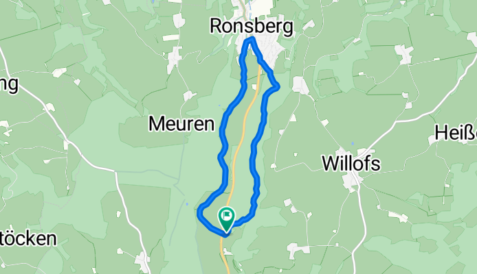
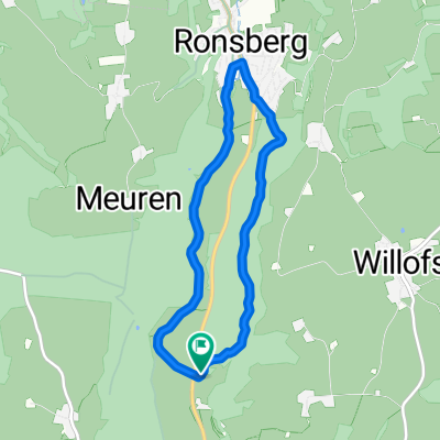
Liebenthannmühle - Ronsberg
A cycling route starting in Obergünzburg, Bavaria, Germany.
Overview
About this route
Am Bach entlang und über Ronsberg durch den Wald über die Hexenküche zurück.
- -:--
- Duration
- 6.9 km
- Distance
- 105 m
- Ascent
- 102 m
- Descent
- ---
- Avg. speed
- ---
- Avg. speed

Route quality
Waytypes & surfaces along the route
Waytypes
Track
4.8 km
(70 %)
Quiet road
1 km
(14 %)
Surfaces
Paved
2.5 km
(36 %)
Unpaved
3.4 km
(50 %)
Gravel
3.1 km
(46 %)
Paved (undefined)
2 km
(28 %)
Continue with Bikemap
Use, edit, or download this cycling route
You would like to ride Liebenthannmühle - Ronsberg or customize it for your own trip? Here is what you can do with this Bikemap route:
Free features
- Save this route as favorite or in collections
- Copy & plan your own version of this route
- Sync your route with Garmin or Wahoo
Premium features
Free trial for 3 days, or one-time payment. More about Bikemap Premium.
- Navigate this route on iOS & Android
- Export a GPX / KML file of this route
- Create your custom printout (try it for free)
- Download this route for offline navigation
Discover more Premium features.
Get Bikemap PremiumFrom our community
Other popular routes starting in Obergünzburg
 Liebenthannmühle - Ronsberg
- Distance
- 6.9 km
- Ascent
- 105 m
- Descent
- 102 m
- Location
- Obergünzburg, Bavaria, Germany
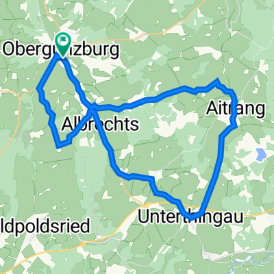
 Obg- Aitrang-Uth-Obg
- Distance
- 32.5 km
- Ascent
- 273 m
- Descent
- 273 m
- Location
- Obergünzburg, Bavaria, Germany
 Obergünzburg-Krumbach-Warmisried-retour
- Distance
- 121.5 km
- Ascent
- 390 m
- Descent
- 390 m
- Location
- Obergünzburg, Bavaria, Germany
 2016_T4_Ostallgäu_Buchloe
- Distance
- 74.5 km
- Ascent
- 226 m
- Descent
- 364 m
- Location
- Obergünzburg, Bavaria, Germany
 Obergünzburg-Rettenbach-Oberegg
- Distance
- 39.3 km
- Ascent
- 687 m
- Descent
- 687 m
- Location
- Obergünzburg, Bavaria, Germany
 34.5_Aitrang_Kraftisried
- Distance
- 34.5 km
- Ascent
- 273 m
- Descent
- 276 m
- Location
- Obergünzburg, Bavaria, Germany
 Lengenwang-Runde im OAL
- Distance
- 72.2 km
- Ascent
- 700 m
- Descent
- 654 m
- Location
- Obergünzburg, Bavaria, Germany
 Oberguenzburg
- Distance
- 43.7 km
- Ascent
- 356 m
- Descent
- 356 m
- Location
- Obergünzburg, Bavaria, Germany
Open it in the app