

Adelaide Hills tour of orchards & vines
A cycling route starting in Hazelwood Park, South Australia, Australia.
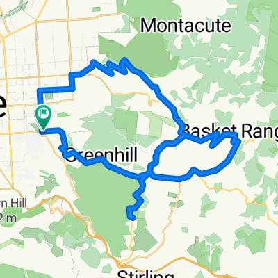
Overview
About this route
This route is tough at the start but gives a rewarding home stretch.
For those not up to greenhill road, start at Summertown. Still plenty of climbs but mostly without traffic.
Not namy shops, but Lobethal good for a mid ride break + cafes.
(cloned from route 107518)
- -:--
- Duration
- 55.5 km
- Distance
- 1,157 m
- Ascent
- 754 m
- Descent
- ---
- Avg. speed
- ---
- Max. altitude
Route quality
Waytypes & surfaces along the route
Waytypes
Busy road
36.3 km
(65 %)
Road
14.1 km
(25 %)
Surfaces
Paved
52.7 km
(95 %)
Unpaved
1.6 km
(3 %)
Asphalt
50.7 km
(91 %)
Paved (undefined)
1.8 km
(3 %)
Continue with Bikemap
Use, edit, or download this cycling route
You would like to ride Adelaide Hills tour of orchards & vines or customize it for your own trip? Here is what you can do with this Bikemap route:
Free features
- Save this route as favorite or in collections
- Copy & plan your own version of this route
- Sync your route with Garmin or Wahoo
Premium features
Free trial for 3 days, or one-time payment. More about Bikemap Premium.
- Navigate this route on iOS & Android
- Export a GPX / KML file of this route
- Create your custom printout (try it for free)
- Download this route for offline navigation
Discover more Premium features.
Get Bikemap PremiumFrom our community
Other popular routes starting in Hazelwood Park
 Adelaide Hills tour of orchards & vines
- Distance
- 55.5 km
- Ascent
- 1,176 m
- Descent
- 876 m
- Location
- Hazelwood Park, South Australia, Australia
 3 Peaks Training Ride
- Distance
- 207.9 km
- Ascent
- 1,813 m
- Descent
- 1,788 m
- Location
- Hazelwood Park, South Australia, Australia
 Feather to tower via gorge, fox, devo,summertown and old norton
- Distance
- 67.1 km
- Ascent
- 818 m
- Descent
- 827 m
- Location
- Hazelwood Park, South Australia, Australia
 Something to do on a sunday
- Distance
- 45.3 km
- Ascent
- 864 m
- Descent
- 859 m
- Location
- Hazelwood Park, South Australia, Australia
 Loop 01
- Distance
- 36 km
- Ascent
- 671 m
- Descent
- 667 m
- Location
- Hazelwood Park, South Australia, Australia
 Adelaide Hills tour of orchards & vines
- Distance
- 55.5 km
- Ascent
- 1,157 m
- Descent
- 754 m
- Location
- Hazelwood Park, South Australia, Australia
 Fastest to Athelstone
- Distance
- 13.5 km
- Ascent
- 134 m
- Descent
- 150 m
- Location
- Hazelwood Park, South Australia, Australia
 Lofty Ascent
- Distance
- 8.4 km
- Ascent
- 646 m
- Descent
- 76 m
- Location
- Hazelwood Park, South Australia, Australia
Open it in the app