

Cycle in Thai 21-2 : Yala - Patttani - Hat Yai - Satun - Trang
A cycling route starting in Yala, Yala, Thailand.
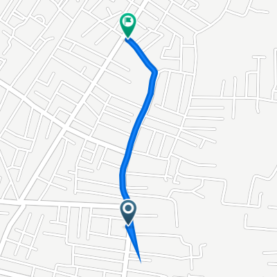
Overview
About this route
Yala --> Pattani --> Songkhla --> Hat Yai --> Satun --> Trang
- -:--
- Duration
- 462.6 km
- Distance
- 310 m
- Ascent
- 318 m
- Descent
- ---
- Avg. speed
- ---
- Max. altitude

Continue with Bikemap
Use, edit, or download this cycling route
You would like to ride Cycle in Thai 21-2 : Yala - Patttani - Hat Yai - Satun - Trang or customize it for your own trip? Here is what you can do with this Bikemap route:
Free features
- Save this route as favorite or in collections
- Copy & plan your own version of this route
- Split it into stages to create a multi-day tour
- Sync your route with Garmin or Wahoo
Premium features
Free trial for 3 days, or one-time payment. More about Bikemap Premium.
- Navigate this route on iOS & Android
- Export a GPX / KML file of this route
- Create your custom printout (try it for free)
- Download this route for offline navigation
Discover more Premium features.
Get Bikemap PremiumFrom our community
Other popular routes starting in Yala
 yala1
yala1- Distance
- 0.5 km
- Ascent
- 7 m
- Descent
- 0 m
- Location
- Yala, Yala, Thailand
 ถนนเวฬุวัน 1 21 to ถนนเวฬุวัน 1 21
- Distance
- 18.4 km
- Ascent
- 20 m
- Descent
- 22 m
- Location
- Yala, Yala, Thailand
 South Thailand Yala - Songkhla - Satun - Krabi - Phuket - Surat Thani
- Distance
- 2,038 km
- Ascent
- 14,268 m
- Descent
- 14,278 m
- Location
- Yala, Yala, Thailand
 Route from Thanon Siroros, Amphoe Mueang Yala
- Distance
- 32.6 km
- Ascent
- 96 m
- Descent
- 96 m
- Location
- Yala, Yala, Thailand
 ซอยแยนาบริหาร to ถนน ผังเมือง 4 ซอย 24
- Distance
- 1.1 km
- Ascent
- 3 m
- Descent
- 0 m
- Location
- Yala, Yala, Thailand
 Recovered Route
- Distance
- 13.5 km
- Ascent
- 49 m
- Descent
- 49 m
- Location
- Yala, Yala, Thailand
 Recovered Route
- Distance
- 13.6 km
- Ascent
- 49 m
- Descent
- 49 m
- Location
- Yala, Yala, Thailand
 Recovered Route
- Distance
- 8.2 km
- Ascent
- 59 m
- Descent
- 8 m
- Location
- Yala, Yala, Thailand
Open it in the app