Zgrupowanie FT - 13.05.2015
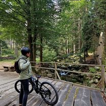
A cycling route starting in Szklarska Por臋ba, Lower Silesian Voivodeship, Poland.
Overview
About this route
Cycling training route - day I
- -:--
- Duration
- 49.4 km
- Distance
- 685 m
- Ascent
- 685 m
- Descent
- ---
- Avg. speed
- ---
- Max. altitude
Route quality
Waytypes & surfaces along the route
Waytypes
Quiet road
6.4 km
(13 %)
Access road
1 km
(2 %)
Surfaces
Paved
45.4 km
(92 %)
Asphalt
45.4 km
(92 %)
Undefined
4 km
(8 %)
Route highlights
Points of interest along the route
Accommodation after 0 km
Bornit
Continue with Bikemap
Use, edit, or download this cycling route
You would like to ride Zgrupowanie FT - 13.05.2015 or customize it for your own trip? Here is what you can do with this Bikemap route:
Free features
- Save this route as favorite or in collections
- Copy & plan your own version of this route
- Sync your route with Garmin or Wahoo
Premium features
Free trial for 3 days, or one-time payment. More about Bikemap Premium.
- Navigate this route on iOS & Android
- Export a GPX / KML file of this route
- Create your custom printout (try it for free)
- Download this route for offline navigation
Discover more Premium features.
Get Bikemap PremiumFrom our community
Other popular routes starting in Szklarska Por臋ba
Zgrupowanie FT - 13.05.2015- Distance
- 49.4 km
- Ascent
- 685 m
- Descent
- 685 m
- Location
- Szklarska Por臋ba, Lower Silesian Voivodeship, Poland
petla izerska- Distance
- 42 km
- Ascent
- 493 m
- Descent
- 494 m
- Location
- Szklarska Por臋ba, Lower Silesian Voivodeship, Poland
Izery- Distance
- 38.9 km
- Ascent
- 633 m
- Descent
- 634 m
- Location
- Szklarska Por臋ba, Lower Silesian Voivodeship, Poland
Fluggaenkoecchicebolsen- Distance
- 295.1 km
- Ascent
- 535 m
- Descent
- 1,069 m
- Location
- Szklarska Por臋ba, Lower Silesian Voivodeship, Poland
Jakuszyce - St贸g Izerski- Distance
- 39.3 km
- Ascent
- 731 m
- Descent
- 730 m
- Location
- Szklarska Por臋ba, Lower Silesian Voivodeship, Poland
Szklarska Por臋ba - Zwalisko - Przednia Kopa- Chatka G贸rzyst贸w- Distance
- 31.5 km
- Ascent
- 619 m
- Descent
- 618 m
- Location
- Szklarska Por臋ba, Lower Silesian Voivodeship, Poland
Labe Tour- Distance
- 407.1 km
- Ascent
- 386 m
- Descent
- 1,567 m
- Location
- Szklarska Por臋ba, Lower Silesian Voivodeship, Poland
SZKLARSKA - LIBEREC/Frydlant/艢wierad贸w - Szklarska- Distance
- 105.8 km
- Ascent
- 1,493 m
- Descent
- 1,462 m
- Location
- Szklarska Por臋ba, Lower Silesian Voivodeship, Poland
Open it in the app


