Daily
- 17.7 km
- 156 m
- 192 m
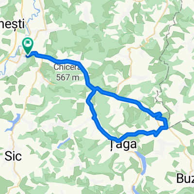
- Gherla, Cluj County, Romania
A cycling route starting in Gherla, Cluj County, Romania.
Overview
A fairly long route of which 70% is paved (road) and 30% is gravel and unpaved road. There is a single climb of 2-3 km in length, followed by a descent from Habadog towards Taga which is wonderful because it has quite a long length. After this massive descent towards Taga, we take the road to the right towards Gherla for about 25 km where there will be paved road (with potholes as usual). Beautiful road. Attention, the area between Diviciori Mici and Habadog cannot be traversed in the rain.
created this 16 years ago
Route highlights
Popasul Rosia (un restaurant rustic pentru toti oameni,aflat la intersectia de drumuri spre taga si spre satele targusor,diviciori.
satul Diviciori mici
Diviciori Mari(sat)
Habadog(cel mai inalt punct din aceasta tura)
Lacul Taga
Comuna Taga
Dealul Chioarului
Continue with Bikemap
You would like to ride Turul balonului or customize it for your own trip? Here is what you can do with this Bikemap route:
Free trial for 3 days, or one-time payment. More about Bikemap Premium.
Discover more Premium features.
Get Bikemap PremiumFrom our community
Open it in the app