

Donauebene und Lonetal
A cycling route starting in Langenau, Baden-Wurttemberg, Germany.
Overview
About this route
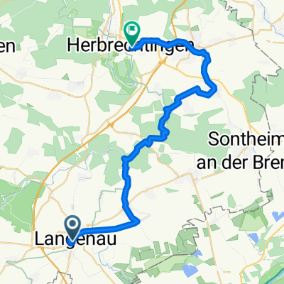
From Langenau through the Donaumoos to Sontheim and through the Brenz valley and Hürbe to Lonetal. Passing Hohlen Stein and climbing up to Lindenau. Return to Langenau via Rammingen.
Initially flat, slightly hilly in the second part.
- -:--
- Duration
- 42.1 km
- Distance
- 214 m
- Ascent
- 214 m
- Descent
- ---
- Avg. speed
- ---
- Max. altitude
Route quality
Waytypes & surfaces along the route
Waytypes
Quiet road
21.5 km
(51 %)
Track
15.6 km
(37 %)
Surfaces
Paved
32.4 km
(77 %)
Unpaved
5.1 km
(12 %)
Asphalt
22.8 km
(54 %)
Paved (undefined)
9.7 km
(23 %)
Continue with Bikemap
Use, edit, or download this cycling route
You would like to ride Donauebene und Lonetal or customize it for your own trip? Here is what you can do with this Bikemap route:
Free features
- Save this route as favorite or in collections
- Copy & plan your own version of this route
- Sync your route with Garmin or Wahoo
Premium features
Free trial for 3 days, or one-time payment. More about Bikemap Premium.
- Navigate this route on iOS & Android
- Export a GPX / KML file of this route
- Create your custom printout (try it for free)
- Download this route for offline navigation
Discover more Premium features.
Get Bikemap PremiumFrom our community
Other popular routes starting in Langenau
 2018 05 31
- Distance
- 34.4 km
- Ascent
- 70 m
- Descent
- 70 m
- Location
- Langenau, Baden-Wurttemberg, Germany
 Samstags im Ried
- Distance
- 37.9 km
- Ascent
- 27 m
- Descent
- 35 m
- Location
- Langenau, Baden-Wurttemberg, Germany
 2019 06 09 testroute
- Distance
- 17.6 km
- Ascent
- 68 m
- Descent
- 70 m
- Location
- Langenau, Baden-Wurttemberg, Germany
 Yoshi
Yoshi- Distance
- 12.9 km
- Ascent
- 46 m
- Descent
- 46 m
- Location
- Langenau, Baden-Wurttemberg, Germany
 2011-09-06 Im Langenauer Ried
- Distance
- 29.7 km
- Ascent
- 32 m
- Descent
- 33 m
- Location
- Langenau, Baden-Wurttemberg, Germany
 Langenau,Schwarzer Beck
- Distance
- 39.2 km
- Ascent
- 345 m
- Descent
- 348 m
- Location
- Langenau, Baden-Wurttemberg, Germany
 1. Langenau-Herbrechtingen (Albtäler)
- Distance
- 31.9 km
- Ascent
- 257 m
- Descent
- 248 m
- Location
- Langenau, Baden-Wurttemberg, Germany
 Langenau - Lonetal - Donauried
- Distance
- 36.3 km
- Ascent
- 147 m
- Descent
- 148 m
- Location
- Langenau, Baden-Wurttemberg, Germany
Open it in the app