

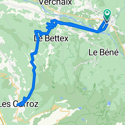
Valle de Samoens
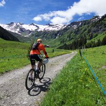
A cycling route starting in Samoëns, Auvergne-Rhône-Alpes, France.
Overview
About this route
Morillon
Samoëns
Sixt-Fer-à-Cheval
Cirque du Fer-à-Cheval
Fond de la Combe
Cirque
Sixt-Fer-à-Cheval
Laferney
Sixt
Vallon d'Haut
Samoëns
Morillon
- -:--
- Duration
- 54.7 km
- Distance
- 705 m
- Ascent
- 703 m
- Descent
- ---
- Avg. speed
- ---
- Max. altitude
Continue with Bikemap
Use, edit, or download this cycling route
You would like to ride Valle de Samoens or customize it for your own trip? Here is what you can do with this Bikemap route:
Free features
- Save this route as favorite or in collections
- Copy & plan your own version of this route
- Sync your route with Garmin or Wahoo
Premium features
Free trial for 3 days, or one-time payment. More about Bikemap Premium.
- Navigate this route on iOS & Android
- Export a GPX / KML file of this route
- Create your custom printout (try it for free)
- Download this route for offline navigation
Discover more Premium features.
Get Bikemap PremiumFrom our community
Other popular routes starting in Samoëns
 Lac de Gers and above
- Distance
- 38.8 km
- Ascent
- 1,673 m
- Descent
- 1,672 m
- Location
- Samoëns, Auvergne-Rhône-Alpes, France
 Itinéraire Trail - 30km
- Distance
- 32.1 km
- Ascent
- 0 m
- Descent
- 0 m
- Location
- Samoëns, Auvergne-Rhône-Alpes, France
 morillon - la prez (Chamonix)
- Distance
- 106.4 km
- Ascent
- 1,817 m
- Descent
- 1,823 m
- Location
- Samoëns, Auvergne-Rhône-Alpes, France
 Samoëns - Les Carroz - Samoëns
- Distance
- 34.9 km
- Ascent
- 1,391 m
- Descent
- 1,391 m
- Location
- Samoëns, Auvergne-Rhône-Alpes, France
 samoens to grand bonard with Romme
- Distance
- 55.4 km
- Ascent
- 1,554 m
- Descent
- 1,331 m
- Location
- Samoëns, Auvergne-Rhône-Alpes, France
 29 - 18 - Samoens - Annecy
- Distance
- 179.8 km
- Ascent
- 3,296 m
- Descent
- 3,548 m
- Location
- Samoëns, Auvergne-Rhône-Alpes, France
 GTJG 7_Samoens-Martigny
- Distance
- 60.9 km
- Ascent
- 2,192 m
- Descent
- 2,431 m
- Location
- Samoëns, Auvergne-Rhône-Alpes, France
 Joux Plane y Joux Verte
- Distance
- 102.8 km
- Ascent
- 2,824 m
- Descent
- 2,824 m
- Location
- Samoëns, Auvergne-Rhône-Alpes, France
Open it in the app