

kyushu day2
A cycling route starting in Karatsu, Saga Prefecture, Japan.
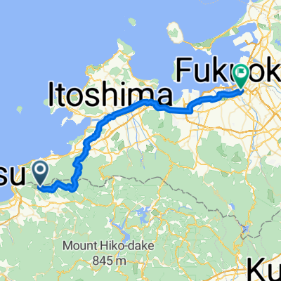
Overview
About this route
- -:--
- Duration
- 87 km
- Distance
- 313 m
- Ascent
- 314 m
- Descent
- ---
- Avg. speed
- ---
- Max. altitude

Continue with Bikemap
Use, edit, or download this cycling route
You would like to ride kyushu day2 or customize it for your own trip? Here is what you can do with this Bikemap route:
Free features
- Save this route as favorite or in collections
- Copy & plan your own version of this route
- Split it into stages to create a multi-day tour
- Sync your route with Garmin or Wahoo
Premium features
Free trial for 3 days, or one-time payment. More about Bikemap Premium.
- Navigate this route on iOS & Android
- Export a GPX / KML file of this route
- Create your custom printout (try it for free)
- Download this route for offline navigation
Discover more Premium features.
Get Bikemap PremiumFrom our community
Other popular routes starting in Karatsu
 Karatsu - Fukuoka
- Distance
- 49.9 km
- Ascent
- 860 m
- Descent
- 1,184 m
- Location
- Karatsu, Saga Prefecture, Japan
 21, Shinkomachi, Karatsu to 4030-6, Nijoyoshii, Itoshima
- Distance
- 17.1 km
- Ascent
- 4 m
- Descent
- 14 m
- Location
- Karatsu, Saga Prefecture, Japan
 街中散策&スイーツ巡り
- Distance
- 5.6 km
- Ascent
- 17 m
- Descent
- 14 m
- Location
- Karatsu, Saga Prefecture, Japan
 Etapa 13: Karatsu - Fukuoka
- Distance
- 71.1 km
- Ascent
- 105 m
- Descent
- 205 m
- Location
- Karatsu, Saga Prefecture, Japan
 海辺の絶景サイクリング
- Distance
- 11.8 km
- Ascent
- 65 m
- Descent
- 64 m
- Location
- Karatsu, Saga Prefecture, Japan
 Karatsu-Nanayama-Kyuragi Loop
- Distance
- 72.7 km
- Ascent
- 890 m
- Descent
- 891 m
- Location
- Karatsu, Saga Prefecture, Japan
 呼子町呼子4185-12, 唐津市 to 二タ子2丁目2-46, 唐津市
- Distance
- 16.9 km
- Ascent
- 354 m
- Descent
- 370 m
- Location
- Karatsu, Saga Prefecture, Japan
 呼子~唐津市街サイクリング
- Distance
- 22.2 km
- Ascent
- 169 m
- Descent
- 165 m
- Location
- Karatsu, Saga Prefecture, Japan
Open it in the app