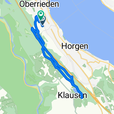
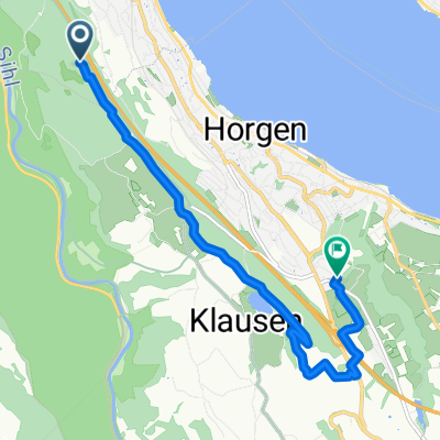
Einsiedeln
A cycling route starting in Oberrieden / Mitte, Canton of Zurich, Switzerland.
Overview
About this route
Fahrt ins Kloster mit einem Abstecher nach Brunni
- -:--
- Duration
- 47.5 km
- Distance
- 716 m
- Ascent
- 258 m
- Descent
- ---
- Avg. speed
- ---
- Avg. speed
Route quality
Waytypes & surfaces along the route
Waytypes
Busy road
31.7 km
(67 %)
Quiet road
6 km
(13 %)
Surfaces
Paved
41 km
(86 %)
Unpaved
0.4 km
(<1 %)
Asphalt
40.6 km
(85 %)
Paved (undefined)
0.3 km
(<1 %)
Continue with Bikemap
Use, edit, or download this cycling route
You would like to ride Einsiedeln or customize it for your own trip? Here is what you can do with this Bikemap route:
Free features
- Save this route as favorite or in collections
- Copy & plan your own version of this route
- Sync your route with Garmin or Wahoo
Premium features
Free trial for 3 days, or one-time payment. More about Bikemap Premium.
- Navigate this route on iOS & Android
- Export a GPX / KML file of this route
- Create your custom printout (try it for free)
- Download this route for offline navigation
Discover more Premium features.
Get Bikemap PremiumFrom our community
Other popular routes starting in Oberrieden / Mitte
- Eins. Str, Hintere Bergstr. Wald Horgner Aebnet
- Distance
- 8.2 km
- Ascent
- 198 m
- Descent
- 197 m
- Location
- Oberrieden / Mitte, Canton of Zurich, Switzerland
- 19.07.2014 08:54
- Distance
- 19.4 km
- Ascent
- 384 m
- Descent
- 386 m
- Location
- Oberrieden / Mitte, Canton of Zurich, Switzerland
- Tour de Säuliamt
- Distance
- 48.1 km
- Ascent
- 782 m
- Descent
- 810 m
- Location
- Oberrieden / Mitte, Canton of Zurich, Switzerland
- Einsiedeln
- Distance
- 47.5 km
- Ascent
- 716 m
- Descent
- 258 m
- Location
- Oberrieden / Mitte, Canton of Zurich, Switzerland
- Horgen-Albis-Sihlbrugg-Menzingen-Schönenberg-Horgen
- Distance
- 46.9 km
- Ascent
- 0 m
- Descent
- 0 m
- Location
- Oberrieden / Mitte, Canton of Zurich, Switzerland
- Wald Oberrieden
- Distance
- 12.1 km
- Ascent
- 246 m
- Descent
- 247 m
- Location
- Oberrieden / Mitte, Canton of Zurich, Switzerland
- 09.08.2014 08:04
- Distance
- 14.2 km
- Ascent
- 283 m
- Descent
- 283 m
- Location
- Oberrieden / Mitte, Canton of Zurich, Switzerland
- 2021 velo
- Distance
- 3,318.5 km
- Ascent
- 1,859 m
- Descent
- 1,859 m
- Location
- Oberrieden / Mitte, Canton of Zurich, Switzerland
Open it in the app