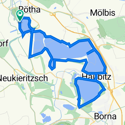
Neuseenland
A cycling route starting in Rötha, Saxony, Germany.
Overview
About this route
Dreiskau-Muckern, Störmthaler See, Markkleeberger See, Markkleeberg, Cospudener See, Zwenkauer See, Zwenkau, Lippendorf, Neukieritzsch, Deutzen, Haselbacher See, Wintersdorf, Gerstenberg, Windischleuba, Eschefeld, Benndorf, Frohburg, Nenkersdorf, Bockwitzer See, Dittmannsdorf, Braußwig, Eula, Großzössen, Kahnsdorf (an der Lagune), zwischen Hainer und Kahnsdorfer See, Espenhain, Dreiskau-Muckern
- -:--
- Duration
- 106.5 km
- Distance
- 212 m
- Ascent
- 216 m
- Descent
- ---
- Avg. speed
- ---
- Avg. speed
Route quality
Waytypes & surfaces along the route
Waytypes
Busy road
30.2 km
(28 %)
Quiet road
25.3 km
(24 %)
Surfaces
Paved
89.3 km
(84 %)
Unpaved
2.7 km
(3 %)
Asphalt
86.3 km
(81 %)
Gravel
2.3 km
(2 %)
Continue with Bikemap
Use, edit, or download this cycling route
You would like to ride Neuseenland or customize it for your own trip? Here is what you can do with this Bikemap route:
Free features
- Save this route as favorite or in collections
- Copy & plan your own version of this route
- Sync your route with Garmin or Wahoo
Premium features
Free trial for 3 days, or one-time payment. More about Bikemap Premium.
- Navigate this route on iOS & Android
- Export a GPX / KML file of this route
- Create your custom printout (try it for free)
- Download this route for offline navigation
Discover more Premium features.
Get Bikemap PremiumFrom our community
Other popular routes starting in Rötha
- Rötha - Schönbach
- Distance
- 59.4 km
- Ascent
- 283 m
- Descent
- 167 m
- Location
- Rötha, Saxony, Germany
- Alte F 95, Großpösna nach Alte F 95, Großpösna
- Distance
- 26.4 km
- Ascent
- 100 m
- Descent
- 102 m
- Location
- Rötha, Saxony, Germany
- Neuseenland
- Distance
- 106.5 km
- Ascent
- 212 m
- Descent
- 216 m
- Location
- Rötha, Saxony, Germany
- Hainer See Runde
- Distance
- 33.6 km
- Ascent
- 167 m
- Descent
- 163 m
- Location
- Rötha, Saxony, Germany
- Hafenstraße 1, Großpösna nach Hafenstraße 1, Großpösna
- Distance
- 23.1 km
- Ascent
- 143 m
- Descent
- 149 m
- Location
- Rötha, Saxony, Germany
- Alte F 95, Großpösna nach Alte F 95, Großpösna
- Distance
- 35.3 km
- Ascent
- 187 m
- Descent
- 186 m
- Location
- Rötha, Saxony, Germany
- Ausfahrt durch Rötha
- Distance
- 25.8 km
- Ascent
- 54 m
- Descent
- 54 m
- Location
- Rötha, Saxony, Germany
- RF SMCS: Strömthaler See--Markkleeberger See--Cospudener See--Störmthaler See
- Distance
- 47.1 km
- Ascent
- 188 m
- Descent
- 189 m
- Location
- Rötha, Saxony, Germany
Open it in the app