

Sellaronda Trail Running 2015
A cycling route starting in Canazei, Trentino-Alto Adige, Italy.
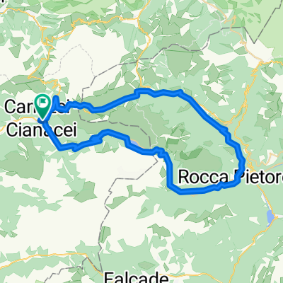
Overview
About this route
Sellaronda Trail Running 2015 modifica 2015maggio21 GPF&DS
- -:--
- Duration
- 59 km
- Distance
- 3,229 m
- Ascent
- 3,228 m
- Descent
- ---
- Avg. speed
- ---
- Max. altitude
Route highlights
Points of interest along the route
Point of interest after 5.9 km
Rif. C.Valentini sentiero 655
Point of interest after 8.6 km
Rif. Comici Sentiero 526 mt 2153
Point of interest after 18.5 km
Rif. Panorama 2130mt Sentiero 12a
Point of interest after 19.2 km
Rif. Dantercepies 2298mt Sentiero 12a
Point of interest after 20.3 km
Rif. Jimmy Sentiero 8a
Point of interest after 33.7 km
Rif. Bec de Roces
Point of interest after 49.9 km
Rif. Vial del Pan
Point of interest after 51.8 km
Rif. Fredarola
Continue with Bikemap
Use, edit, or download this cycling route
You would like to ride Sellaronda Trail Running 2015 or customize it for your own trip? Here is what you can do with this Bikemap route:
Free features
- Save this route as favorite or in collections
- Copy & plan your own version of this route
- Sync your route with Garmin or Wahoo
Premium features
Free trial for 3 days, or one-time payment. More about Bikemap Premium.
- Navigate this route on iOS & Android
- Export a GPX / KML file of this route
- Create your custom printout (try it for free)
- Download this route for offline navigation
Discover more Premium features.
Get Bikemap PremiumFrom our community
Other popular routes starting in Canazei
 Route 10_2017 TWC Platters_Pordoi en Fedaia
- Distance
- 67.5 km
- Ascent
- 1,848 m
- Descent
- 1,843 m
- Location
- Canazei, Trentino-Alto Adige, Italy
 DO_3_Passo Pordoi_CAVALESE
- Distance
- 55.4 km
- Ascent
- 45 m
- Descent
- 1,445 m
- Location
- Canazei, Trentino-Alto Adige, Italy
 Sellaronda Trail Running 2015
- Distance
- 59 km
- Ascent
- 3,229 m
- Descent
- 3,228 m
- Location
- Canazei, Trentino-Alto Adige, Italy
 MTB Sellaronda Camp_3 diena_Sella ring tour
- Distance
- 48.6 km
- Ascent
- 1,506 m
- Descent
- 2,341 m
- Location
- Canazei, Trentino-Alto Adige, Italy
 Sella Ronda
- Distance
- 51.5 km
- Ascent
- 1,601 m
- Descent
- 1,633 m
- Location
- Canazei, Trentino-Alto Adige, Italy
 Canazei - Fedaia - Pordoi - Canazei
- Distance
- 55.4 km
- Ascent
- 2,776 m
- Descent
- 2,776 m
- Location
- Canazei, Trentino-Alto Adige, Italy
 Canazei-Moena-Pso S. Pellegrino-Falcade-Cencenighe-Alleghe-Caprile-Pso Fedáia-Canazei
- Distance
- 88.3 km
- Ascent
- 2,266 m
- Descent
- 1,961 m
- Location
- Canazei, Trentino-Alto Adige, Italy
 canazei-campitello-val duron-pass duron_passdetier
- Distance
- 14.9 km
- Ascent
- 1,083 m
- Descent
- 75 m
- Location
- Canazei, Trentino-Alto Adige, Italy
Open it in the app