

IV Erfurter Night Bike Challenge 2021
A cycling route starting in Mönchenholzhausen, Thuringia, Germany.
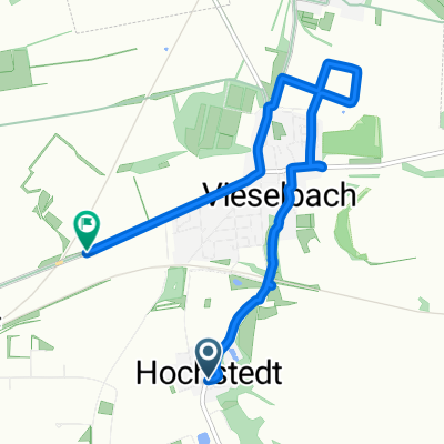
Overview
About this route
V EBNC 2021
- -:--
- Duration
- 135.8 km
- Distance
- 835 m
- Ascent
- 871 m
- Descent
- ---
- Avg. speed
- ---
- Max. altitude

Route quality
Waytypes & surfaces along the route
Waytypes
Track
40.8 km
(30 %)
Quiet road
34 km
(25 %)
Surfaces
Paved
110 km
(81 %)
Unpaved
21.7 km
(16 %)
Asphalt
108.7 km
(80 %)
Gravel
12.2 km
(9 %)
Continue with Bikemap
Use, edit, or download this cycling route
You would like to ride IV Erfurter Night Bike Challenge 2021 or customize it for your own trip? Here is what you can do with this Bikemap route:
Free features
- Save this route as favorite or in collections
- Copy & plan your own version of this route
- Split it into stages to create a multi-day tour
- Sync your route with Garmin or Wahoo
Premium features
Free trial for 3 days, or one-time payment. More about Bikemap Premium.
- Navigate this route on iOS & Android
- Export a GPX / KML file of this route
- Create your custom printout (try it for free)
- Download this route for offline navigation
Discover more Premium features.
Get Bikemap PremiumFrom our community
Other popular routes starting in Mönchenholzhausen
 Stiefelburgsrunde 1
- Distance
- 23.1 km
- Ascent
- 367 m
- Descent
- 304 m
- Location
- Mönchenholzhausen, Thuringia, Germany
 Büßleben-Weimar
- Distance
- 45.3 km
- Ascent
- 266 m
- Descent
- 266 m
- Location
- Mönchenholzhausen, Thuringia, Germany
 IV Erfurter Night Bike Challenge 2021
- Distance
- 135.8 km
- Ascent
- 835 m
- Descent
- 871 m
- Location
- Mönchenholzhausen, Thuringia, Germany
 20250919_Urbich-Elgersburg
- Distance
- 44.7 km
- Ascent
- 471 m
- Descent
- 130 m
- Location
- Mönchenholzhausen, Thuringia, Germany
 Bei den Froschäckern 4, Erfurt do Ernst-Haeckel-Straße 6, Erfurt
- Distance
- 5.9 km
- Ascent
- 54 m
- Descent
- 23 m
- Location
- Mönchenholzhausen, Thuringia, Germany
 Männertagsrunde 2
- Distance
- 44.1 km
- Ascent
- 208 m
- Descent
- 207 m
- Location
- Mönchenholzhausen, Thuringia, Germany
 Waidgarten nach Vieselbacher Straße Brücke
- Distance
- 7.5 km
- Ascent
- 38 m
- Descent
- 87 m
- Location
- Mönchenholzhausen, Thuringia, Germany
 Radtour
- Distance
- 27.5 km
- Ascent
- 319 m
- Descent
- 319 m
- Location
- Mönchenholzhausen, Thuringia, Germany
Open it in the app