

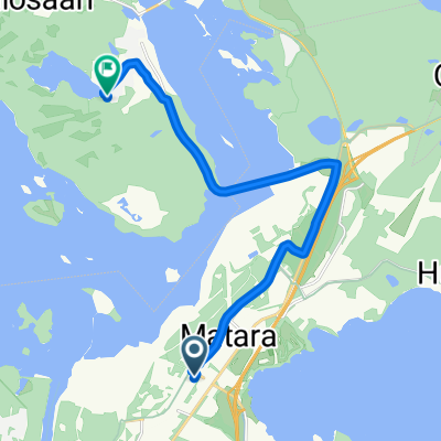
immalanjarvi-miettila
A cycling route starting in Ruokolahti, South Karelia, Finland.
Overview
About this route
Дорога 3981 имеет статус музейной, и это не просто слова. Дорога действительно очень красивая, идет по высоким местам, с нее открываются хорошие виды на поля, озера. На ней можно увидеть редкий даже для Финляндии дорожный знак «Пересечение с лыжней». Ничего удивительного – иногда в местах пересечения с дорогой для лыжников сооружают даже мосты! Лыжник проезжает над дорогой, не выходя на проезжую часть! Из достопримечательностей встретятся старые казармы (музей), расположенные в Miettilä. Далее в Simpele есть кирха и дом священника (музей). В местечке, обозначенном на карте как Patsaspuisto, что справа от дороги перед Joukio, есть важная достопримечательность. Я бы назвал ее «Парком параноидальной скульптуры», или, по-английски «most important ensemble of contemporary folk art».
- -:--
- Duration
- 47.6 km
- Distance
- 160 m
- Ascent
- 160 m
- Descent
- ---
- Avg. speed
- ---
- Max. altitude
Route quality
Waytypes & surfaces along the route
Waytypes
Road
39 km
(82 %)
Path
5.7 km
(12 %)
Cycleway
2.9 km
(6 %)
Surfaces
Paved
47.6 km
(100 %)
Asphalt
47.6 km
(100 %)
Continue with Bikemap
Use, edit, or download this cycling route
You would like to ride immalanjarvi-miettila or customize it for your own trip? Here is what you can do with this Bikemap route:
Free features
- Save this route as favorite or in collections
- Copy & plan your own version of this route
- Sync your route with Garmin or Wahoo
Premium features
Free trial for 3 days, or one-time payment. More about Bikemap Premium.
- Navigate this route on iOS & Android
- Export a GPX / KML file of this route
- Create your custom printout (try it for free)
- Download this route for offline navigation
Discover more Premium features.
Get Bikemap PremiumFrom our community
Other popular routes starting in Ruokolahti
 Peltolankatu 57, Imatra to Järvikuja 6, Ruokolahti
- Distance
- 10.2 km
- Ascent
- 93 m
- Descent
- 73 m
- Location
- Ruokolahti, South Karelia, Finland
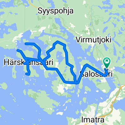
 Rautjärvi-Pohja Lankila-Runde
- Distance
- 78.3 km
- Ascent
- 228 m
- Descent
- 228 m
- Location
- Ruokolahti, South Karelia, Finland
 Finland Holiday, '11, day 2b
- Distance
- 125.7 km
- Ascent
- 252 m
- Descent
- 260 m
- Location
- Ruokolahti, South Karelia, Finland
 Järvikuja 6, Ruokolahti to Näreharju 23, Imatra
- Distance
- 10.8 km
- Ascent
- 10 m
- Descent
- 30 m
- Location
- Ruokolahti, South Karelia, Finland
 Imatra lentokentän ympäri
- Distance
- 19.7 km
- Ascent
- 76 m
- Descent
- 75 m
- Location
- Ruokolahti, South Karelia, Finland
 Äitsaari Inselrunde
- Distance
- 87.2 km
- Ascent
- 293 m
- Descent
- 293 m
- Location
- Ruokolahti, South Karelia, Finland
 Vuoksenniskantie 70, Imatra to Joutsenonkatu 60, Imatra
- Distance
- 6.8 km
- Ascent
- 4 m
- Descent
- 9 m
- Location
- Ruokolahti, South Karelia, Finland
 Järvikuja 4, Ruokolahti to Näreharju 23, Imatra
- Distance
- 13.1 km
- Ascent
- 87 m
- Descent
- 105 m
- Location
- Ruokolahti, South Karelia, Finland
Open it in the app