

bike ride 1
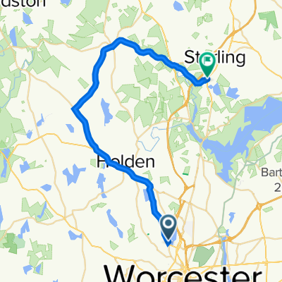
A cycling route starting in Worcester, Massachusetts, United States of America.
Overview
About this route
A lot of ups and downs going through Worcester auburn and millbury
- -:--
- Duration
- 19.1 km
- Distance
- 191 m
- Ascent
- 193 m
- Descent
- ---
- Avg. speed
- ---
- Avg. speed
Route quality
Waytypes & surfaces along the route
Waytypes
Busy road
9.3 km
(49 %)
Quiet road
4.5 km
(24 %)
Surfaces
Paved
2.9 km
(15 %)
Unpaved
0 km
(<1 %)
Asphalt
2.1 km
(11 %)
Paved (undefined)
0.8 km
(4 %)
Continue with Bikemap
Use, edit, or download this cycling route
You would like to ride bike ride 1 or customize it for your own trip? Here is what you can do with this Bikemap route:
Free features
- Save this route as favorite or in collections
- Copy & plan your own version of this route
- Sync your route with Garmin or Wahoo
Premium features
Free trial for 3 days, or one-time payment. More about Bikemap Premium.
- Navigate this route on iOS & Android
- Export a GPX / KML file of this route
- Create your custom printout (try it for free)
- Download this route for offline navigation
Discover more Premium features.
Get Bikemap PremiumFrom our community
Other popular routes starting in Worcester
 Ashmont Ave, Worcester to 4 Ashmont Ave, Worcester
- Distance
- 837.4 km
- Ascent
- 166 m
- Descent
- 169 m
- Location
- Worcester, Massachusetts, United States of America
 Oct. 25, 2017
- Distance
- 48.4 km
- Ascent
- 405 m
- Descent
- 405 m
- Location
- Worcester, Massachusetts, United States of America
 bike ride 1
- Distance
- 19.1 km
- Ascent
- 191 m
- Descent
- 193 m
- Location
- Worcester, Massachusetts, United States of America
 Indian Lake East, Worcester to 117 Worcester Rd, Sterling
- Distance
- 33 km
- Ascent
- 605 m
- Descent
- 632 m
- Location
- Worcester, Massachusetts, United States of America
 Worcester
- Distance
- 25.5 km
- Ascent
- 296 m
- Descent
- 296 m
- Location
- Worcester, Massachusetts, United States of America
 Worcester
- Distance
- 24.9 km
- Ascent
- 297 m
- Descent
- 297 m
- Location
- Worcester, Massachusetts, United States of America
 Beechmont Street 7, Worcester to Stowell Avenue 2A, Worcester
- Distance
- 8.3 km
- Ascent
- 46 m
- Descent
- 68 m
- Location
- Worcester, Massachusetts, United States of America
 9 Hackfeld Rd, Worcester to 7 Woodland Ct, Princeton Junction
- Distance
- 406.6 km
- Ascent
- 2,788 m
- Descent
- 2,913 m
- Location
- Worcester, Massachusetts, United States of America
Open it in the app