

SJB Ride 20150515
A cycling route starting in Saint Louis Park, Minnesota, United States.
Overview
About this route
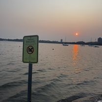
Nice day, 67F Degrees, light breeze. Once around Calhoun, east on Greenway to Mississippi River, south to Minnehaha Park, west to Lake Harriet, north back to Lake Calhoun parking spot.
- -:--
- Duration
- 34.1 km
- Distance
- 97 m
- Ascent
- 99 m
- Descent
- ---
- Avg. speed
- ---
- Max. altitude
Route quality
Waytypes & surfaces along the route
Waytypes
Cycleway
31.7 km
(93 %)
Road
1.4 km
(4 %)
Quiet road
1 km
(3 %)
Surfaces
Paved
33 km
(97 %)
Asphalt
31 km
(91 %)
Paved (undefined)
1.7 km
(5 %)
Continue with Bikemap
Use, edit, or download this cycling route
You would like to ride SJB Ride 20150515 or customize it for your own trip? Here is what you can do with this Bikemap route:
Free features
- Save this route as favorite or in collections
- Copy & plan your own version of this route
- Sync your route with Garmin or Wahoo
Premium features
Free trial for 3 days, or one-time payment. More about Bikemap Premium.
- Navigate this route on iOS & Android
- Export a GPX / KML file of this route
- Create your custom printout (try it for free)
- Download this route for offline navigation
Discover more Premium features.
Get Bikemap PremiumFrom our community
Other popular routes starting in Saint Louis Park
 SJB Ride 20150515
- Distance
- 34.1 km
- Ascent
- 97 m
- Descent
- 99 m
- Location
- Saint Louis Park, Minnesota, United States
 Midtown Greenway, Minneapolis to Hennepin Ave, Minneapolis
- Distance
- 3.9 km
- Ascent
- 32 m
- Descent
- 32 m
- Location
- Saint Louis Park, Minnesota, United States
 Glencrest Rd, Golden Valley to Thomas Ave N, Minneapolis
- Distance
- 3.5 km
- Ascent
- 29 m
- Descent
- 43 m
- Location
- Saint Louis Park, Minnesota, United States
 Regional Trail Loop St. Louis Park
- Distance
- 21.1 km
- Ascent
- 61 m
- Descent
- 63 m
- Location
- Saint Louis Park, Minnesota, United States
 B2B 00004- 55408-->55435- 28th St and Lyndale Ave South to W77th St, Edina
- Distance
- 13.7 km
- Ascent
- 34 m
- Descent
- 51 m
- Location
- Saint Louis Park, Minnesota, United States
 Bloomington 50
- Distance
- 73.9 km
- Ascent
- 438 m
- Descent
- 438 m
- Location
- Saint Louis Park, Minnesota, United States
 Cedar Lake Trail, St. Louis Park to 1406 Spruce Pl, Minneapolis
- Distance
- 25.5 km
- Ascent
- 110 m
- Descent
- 126 m
- Location
- Saint Louis Park, Minnesota, United States
 Meadow Ln S, Golden Valley to Tonka Bay Rd, Tonka Bay
- Distance
- 32.4 km
- Ascent
- 130 m
- Descent
- 110 m
- Location
- Saint Louis Park, Minnesota, United States
Open it in the app