

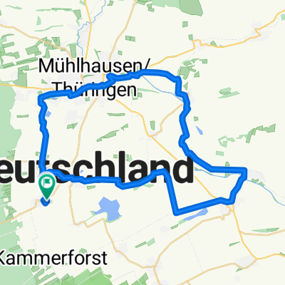
Langula-Altengottern
A cycling route starting in Langula, Thuringia, Germany.
Overview
About this route
Connecting/shortcut section between the UWR and UNS cycle routes. Asphalt, with sections of concrete slabs in acceptable condition. About 2 km of lightly trafficked county road, the rest cycle and farm roads.
- -:--
- Duration
- 16.1 km
- Distance
- 39 m
- Ascent
- 117 m
- Descent
- ---
- Avg. speed
- ---
- Max. altitude
Continue with Bikemap
Use, edit, or download this cycling route
You would like to ride Langula-Altengottern or customize it for your own trip? Here is what you can do with this Bikemap route:
Free features
- Save this route as favorite or in collections
- Copy & plan your own version of this route
- Sync your route with Garmin or Wahoo
Premium features
Free trial for 3 days, or one-time payment. More about Bikemap Premium.
- Navigate this route on iOS & Android
- Export a GPX / KML file of this route
- Create your custom printout (try it for free)
- Download this route for offline navigation
Discover more Premium features.
Get Bikemap PremiumFrom our community
Other popular routes starting in Langula
 Eisenacher Straße 1, Vogtei nach Eisenacher Straße 5, Vogtei
- Distance
- 54.6 km
- Ascent
- 827 m
- Descent
- 825 m
- Location
- Langula, Thuringia, Germany
 Langula - MHL - Langula Runde
- Distance
- 40.5 km
- Ascent
- 127 m
- Descent
- 126 m
- Location
- Langula, Thuringia, Germany
 Langula - Unstrut-Werra-Radweg - Ebeleben
- Distance
- 46.2 km
- Ascent
- 143 m
- Descent
- 156 m
- Location
- Langula, Thuringia, Germany
 Langula-Altengottern
- Distance
- 16.1 km
- Ascent
- 39 m
- Descent
- 117 m
- Location
- Langula, Thuringia, Germany
 Bornsgasse 29, Langula nach Ammerstraße 83, Mühlhausen/Thüringen
- Distance
- 10.3 km
- Ascent
- 101 m
- Descent
- 128 m
- Location
- Langula, Thuringia, Germany
 Langula - Untrutradweg - Herbsleben
- Distance
- 41.4 km
- Ascent
- 99 m
- Descent
- 154 m
- Location
- Langula, Thuringia, Germany
 Eichsfeld 2020
- Distance
- 211.7 km
- Ascent
- 1,238 m
- Descent
- 1,279 m
- Location
- Langula, Thuringia, Germany
 Langl
Langl- Distance
- 5.4 km
- Ascent
- 45 m
- Descent
- 55 m
- Location
- Langula, Thuringia, Germany
Open it in the app