

Taman Pertanian
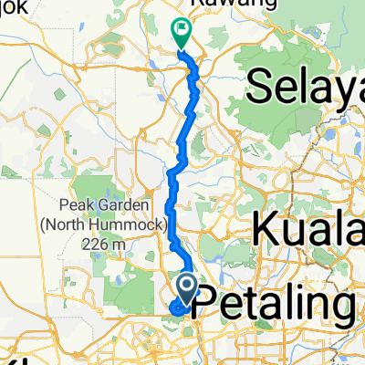
A cycling route starting in Shah Alam, Selangor, Malaysia.
Overview
About this route
17/5/15 11:52 am
- -:--
- Duration
- 19.3 km
- Distance
- 293 m
- Ascent
- 300 m
- Descent
- ---
- Avg. speed
- ---
- Max. altitude
Continue with Bikemap
Use, edit, or download this cycling route
You would like to ride Taman Pertanian or customize it for your own trip? Here is what you can do with this Bikemap route:
Free features
- Save this route as favorite or in collections
- Copy & plan your own version of this route
- Sync your route with Garmin or Wahoo
Premium features
Free trial for 3 days, or one-time payment. More about Bikemap Premium.
- Navigate this route on iOS & Android
- Export a GPX / KML file of this route
- Create your custom printout (try it for free)
- Download this route for offline navigation
Discover more Premium features.
Get Bikemap PremiumFrom our community
Other popular routes starting in Shah Alam
 Shah Alam Tour - Santai Ride
- Distance
- 21.6 km
- Ascent
- 201 m
- Descent
- 199 m
- Location
- Shah Alam, Selangor, Malaysia
 From Shah Alam to Rawang
- Distance
- 30.5 km
- Ascent
- 350 m
- Descent
- 303 m
- Location
- Shah Alam, Selangor, Malaysia
 Route from KPJ Jalan Tupai 20/16, Damansara
- Distance
- 14.9 km
- Ascent
- 52 m
- Descent
- 57 m
- Location
- Shah Alam, Selangor, Malaysia
 GCE - Guhtrie Normal Loop
- Distance
- 43 km
- Ascent
- 408 m
- Descent
- 396 m
- Location
- Shah Alam, Selangor, Malaysia
 kayuhan amatur noob sedunia
- Distance
- 14.7 km
- Ascent
- 0 m
- Descent
- 0 m
- Location
- Shah Alam, Selangor, Malaysia
 Persiaran Bandar Raya, Shah Alam to Persiaran Bandar Raya, Shah Alam
- Distance
- 8.9 km
- Ascent
- 170 m
- Descent
- 173 m
- Location
- Shah Alam, Selangor, Malaysia
 Taman Pertanian
- Distance
- 19.3 km
- Ascent
- 293 m
- Descent
- 300 m
- Location
- Shah Alam, Selangor, Malaysia
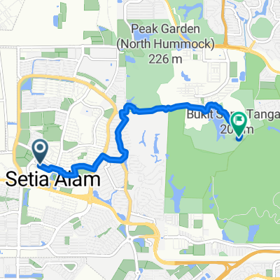 Shah Alam to Taman Pertanian Bukit Cahaya Seri Alam, Shah Alam
- Distance
- 7.5 km
- Ascent
- 371 m
- Descent
- 181 m
- Location
- Shah Alam, Selangor, Malaysia
Open it in the app