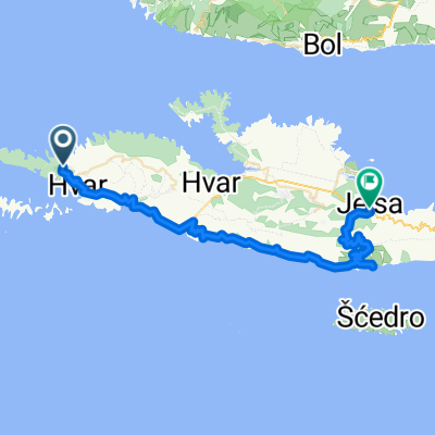
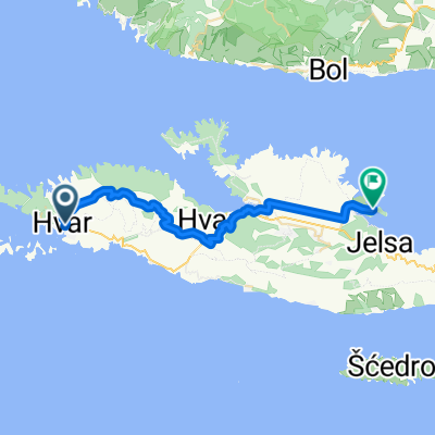
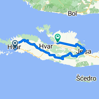
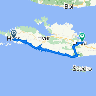
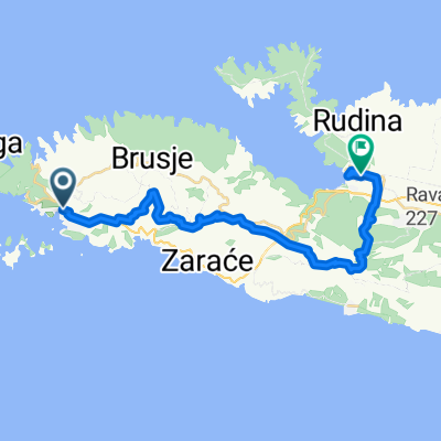
HVAR 2
A cycling route starting in Hvar, Splitsko-Dalmatinska Županija, Croatia.
Overview
About this route
None
(cloned from route 1100306)
- -:--
- Duration
- 42.4 km
- Distance
- 758 m
- Ascent
- 774 m
- Descent
- ---
- Avg. speed
- ---
- Avg. speed
Route quality
Waytypes & surfaces along the route
Waytypes
Track
19.8 km
(47 %)
Busy road
8.5 km
(20 %)
Surfaces
Paved
10.1 km
(24 %)
Unpaved
11.5 km
(27 %)
Gravel
11.5 km
(27 %)
Paved (undefined)
5.3 km
(12 %)
Route highlights
Points of interest along the route
Point of interest after 18.9 km
Continue with Bikemap
Use, edit, or download this cycling route
You would like to ride HVAR 2 or customize it for your own trip? Here is what you can do with this Bikemap route:
Free features
- Save this route as favorite or in collections
- Copy & plan your own version of this route
- Sync your route with Garmin or Wahoo
Premium features
Free trial for 3 days, or one-time payment. More about Bikemap Premium.
- Navigate this route on iOS & Android
- Export a GPX / KML file of this route
- Create your custom printout (try it for free)
- Download this route for offline navigation
Discover more Premium features.
Get Bikemap PremiumFrom our community
Other popular routes starting in Hvar
- Moderate route in Sveta Nedjeljay
- Distance
- 17.5 km
- Ascent
- 731 m
- Descent
- 637 m
- Location
- Hvar, Splitsko-Dalmatinska Županija, Croatia
- Hvar - Stari Grad
- Distance
- 47.3 km
- Ascent
- 919 m
- Descent
- 949 m
- Location
- Hvar, Splitsko-Dalmatinska Županija, Croatia
- Hvar to stari grad
- Distance
- 21.7 km
- Ascent
- 413 m
- Descent
- 420 m
- Location
- Hvar, Splitsko-Dalmatinska Županija, Croatia
- HVAR 2
- Distance
- 42.4 km
- Ascent
- 758 m
- Descent
- 774 m
- Location
- Hvar, Splitsko-Dalmatinska Županija, Croatia
- BCR-6 - Hvar 1/2
- Distance
- 21.2 km
- Ascent
- 432 m
- Descent
- 438 m
- Location
- Hvar, Splitsko-Dalmatinska Županija, Croatia
- Hvar a Sucuraj (Ferry) Ploce
- Distance
- 93 km
- Ascent
- 1,673 m
- Descent
- 1,667 m
- Location
- Hvar, Splitsko-Dalmatinska Županija, Croatia
- Walking to Motohit
- Distance
- 3.6 km
- Ascent
- 327 m
- Descent
- 334 m
- Location
- Hvar, Splitsko-Dalmatinska Županija, Croatia
- Odcep Vira
- Distance
- 3.8 km
- Ascent
- 137 m
- Descent
- 142 m
- Location
- Hvar, Splitsko-Dalmatinska Županija, Croatia