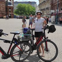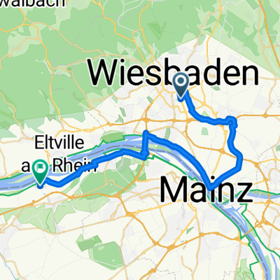
Vatertag 2019
- 30.5 km
- 345 m
- 349 m
- Wiesbaden, Hesse, Germany
A cycling route starting in Wiesbaden, Hesse, Germany.
Overview
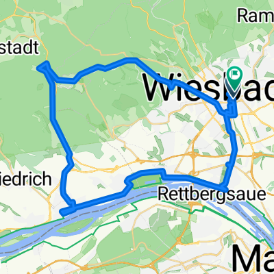
haegers Tour 07/2011
The route starts with a short flat warm-up phase and then immediately heads uphill with a fair amount of climbing towards Wi-Naurod, Kellerskopf and straight on to the Platte – some parts are quite steep, but easy to handle with an MTB ;)
Continue over the Platte, always through the forest, past Eiserne Hand and then on to the Hohe Wurzel – with a pretty steep climb of about 120 vertical meters in one go!
Then comes the descent to Georgenborn and Wi-Frauenstein – offering extremely beautiful panoramic views above Wi-Frauenstein.
From Wi-Frauenstein, continue to Wi-Schierstein – here, you should definitely make a short stop at the delicious Frauensteiner cherry trees (seasonal!).
From Wi-Schierstein, continue along the R3 cycle path, beautifully right along the Rhine via Wi-Biebrich to Kostheim – here you could take a little break on the Rhine beach!
From here it is about 15 km to Wi-Igstadt, mostly flat!
Have fun!
Regards, haegers
(cloned from route 1098038)
(cloned from route 3033701)
created this 10 years ago
Route highlights

Jagdschloss Platte Das Jagdschloss Platte ist ein ursprünglich klassizistisches, ehemaliges Jagdschloss im hessischen Mittelgebirge Taunus bei Wiesbaden, das der nassauische Herzog Wilhelm I. 1823–1826 errichten ließ. Im Zweiten Weltkrieg wurde es am 3. Februar 1945 bei einem Luftangriff bis auf die Außenmauern zerstört. Seit Ende der 1980er-Jahre wird es von einer Stiftung wieder aufgebaut. 2003 erhielt es ein modernes Glasdach. Das Jagdschloss Platte steht im Naturpark Rhein-Taunus an der Nordgrenze des Stadtgebiets von Wiesbaden; direkt nördlich verläuft die Stadtgrenze von Taunusstein. Es befindet sich auf dem Taunushauptkamm auf der bewaldeten Platte (498 m ü. NN[1]), einer Hochfläche südwestlich der Kuppe des Bergs Steinhaufen (520,6 m ü. NN).
Hohe Wurzel Die Hohe Wurzel im Taunus ist mit 618 m die zweithöchste Erhebung im Rheingau-Taunus-Kreis und gleichzeitig höchste Erhebung Wiesbadens.
Fernmeldeturm Hohe Wurzel Er befindet sich auf dem gleichnamigen Berg im Taunus. Es ist ein 133 Meter hoher Fernmeldeturm in Stahlbetonbauweise, welcher das Rhein-Main-Gebiet im Gleichwellenbetrieb mit anderen Standorten mit digitalem Fernsehen (DVB-T) versorgt.
Frauensteiner Kirschen

Rhein-Strand

Kreiselbrücke
Continue with Bikemap
You would like to ride WI-Igstadt > Hohe Wurzel > Rund um Wiesbaden zurück! or customize it for your own trip? Here is what you can do with this Bikemap route:
Free trial for 3 days, or one-time payment. More about Bikemap Premium.
Discover more Premium features.
Get Bikemap PremiumFrom our community
Open it in the app