

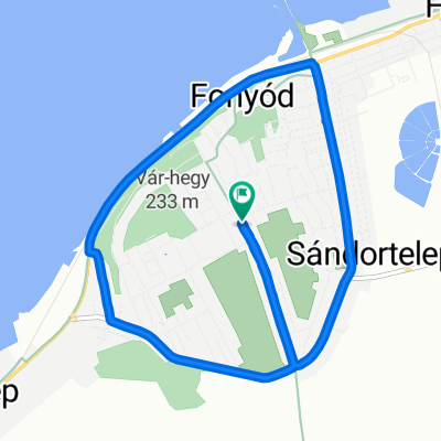
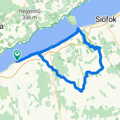
balcsi
A cycling route starting in Fonyód, Somogy County, Hungary.
Overview
About this route
- -:--
- Duration
- 203.4 km
- Distance
- 345 m
- Ascent
- 371 m
- Descent
- ---
- Avg. speed
- ---
- Max. altitude
Continue with Bikemap
Use, edit, or download this cycling route
You would like to ride balcsi or customize it for your own trip? Here is what you can do with this Bikemap route:
Free features
- Save this route as favorite or in collections
- Copy & plan your own version of this route
- Split it into stages to create a multi-day tour
- Sync your route with Garmin or Wahoo
Premium features
Free trial for 3 days, or one-time payment. More about Bikemap Premium.
- Navigate this route on iOS & Android
- Export a GPX / KML file of this route
- Create your custom printout (try it for free)
- Download this route for offline navigation
Discover more Premium features.
Get Bikemap PremiumFrom our community
Other popular routes starting in Fonyód
 Fonyód -Öreglak-Marcali-Fonyód
- Distance
- 69.3 km
- Ascent
- 180 m
- Descent
- 180 m
- Location
- Fonyód, Somogy County, Hungary
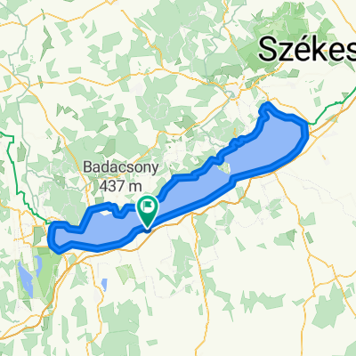
 Balaton kör
- Distance
- 204.9 km
- Ascent
- 622 m
- Descent
- 621 m
- Location
- Fonyód, Somogy County, Hungary
 Fürdő utca 40, Fonyód to Fürdő utca 40, Fonyód
- Distance
- 50.9 km
- Ascent
- 161 m
- Descent
- 153 m
- Location
- Fonyód, Somogy County, Hungary
 balcsi
- Distance
- 203.4 km
- Ascent
- 345 m
- Descent
- 371 m
- Location
- Fonyód, Somogy County, Hungary
 Fő utca, Fonyód - Fő utca, Fonyód
- Distance
- 8.7 km
- Ascent
- 76 m
- Descent
- 80 m
- Location
- Fonyód, Somogy County, Hungary
 Balston kör
- Distance
- 205.9 km
- Ascent
- 401 m
- Descent
- 400 m
- Location
- Fonyód, Somogy County, Hungary
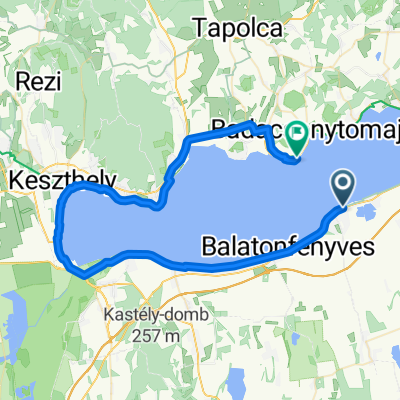 József utca, Fonyód to 71-es főút, Badacsonytomaj
- Distance
- 60.5 km
- Ascent
- 131 m
- Descent
- 138 m
- Location
- Fonyód, Somogy County, Hungary
 Fonyódliget start 108k országút a Somogyban (Andoccsal)
- Distance
- 108.4 km
- Ascent
- 845 m
- Descent
- 844 m
- Location
- Fonyód, Somogy County, Hungary
Open it in the app