

Mountainbike Strecke
A cycling route starting in Wilhelmsdorf, Baden-Wurttemberg, Germany.
Overview
About this route
Eine kleine gemütliche Runde auf den Höchsten und durch das Pfrunger-Burgweiler Ried
- -:--
- Duration
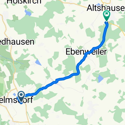
- 34.2 km
- Distance
- 301 m
- Ascent
- 302 m
- Descent
- ---
- Avg. speed
- ---
- Max. altitude
Route quality
Waytypes & surfaces along the route
Waytypes
Track
18.4 km
(54 %)
Quiet road
5.4 km
(16 %)
Surfaces
Paved
21.4 km
(63 %)
Unpaved
12.6 km
(37 %)
Asphalt
21.3 km
(62 %)
Loose gravel
5.3 km
(16 %)
Continue with Bikemap
Use, edit, or download this cycling route
You would like to ride Mountainbike Strecke or customize it for your own trip? Here is what you can do with this Bikemap route:
Free features
- Save this route as favorite or in collections
- Copy & plan your own version of this route
- Sync your route with Garmin or Wahoo
Premium features
Free trial for 3 days, or one-time payment. More about Bikemap Premium.
- Navigate this route on iOS & Android
- Export a GPX / KML file of this route
- Create your custom printout (try it for free)
- Download this route for offline navigation
Discover more Premium features.
Get Bikemap PremiumFrom our community
Other popular routes starting in Wilhelmsdorf
 Bräuhaus Zussdorf -FN via Horgenzell
- Distance
- 30.8 km
- Ascent
- 202 m
- Descent
- 392 m
- Location
- Wilhelmsdorf, Baden-Wurttemberg, Germany
 Ostrach 2
- Distance
- 38.5 km
- Ascent
- 198 m
- Descent
- 210 m
- Location
- Wilhelmsdorf, Baden-Wurttemberg, Germany
 Schmiedergässle 3, Wilhelmsdorf nach Max-Planck-Straße 6, Altshausen
- Distance
- 12 km
- Ascent
- 100 m
- Descent
- 133 m
- Location
- Wilhelmsdorf, Baden-Wurttemberg, Germany
 Ab zum Bodensee
- Distance
- 33 km
- Ascent
- 342 m
- Descent
- 586 m
- Location
- Wilhelmsdorf, Baden-Wurttemberg, Germany
 Mountainbike Strecke
- Distance
- 34.2 km
- Ascent
- 301 m
- Descent
- 302 m
- Location
- Wilhelmsdorf, Baden-Wurttemberg, Germany
 2 Zussdorf - Sigmaringen
- Distance
- 45.3 km
- Ascent
- 337 m
- Descent
- 349 m
- Location
- Wilhelmsdorf, Baden-Wurttemberg, Germany
 Ravensburger Straße 9, Wilhelmsdorf nach Ravensburger Straße 4, Wilhelmsdorf
- Distance
- 73.9 km
- Ascent
- 505 m
- Descent
- 504 m
- Location
- Wilhelmsdorf, Baden-Wurttemberg, Germany
 Zussdorf-Hohentengen-Koenigsegg
- Distance
- 81.4 km
- Ascent
- 391 m
- Descent
- 390 m
- Location
- Wilhelmsdorf, Baden-Wurttemberg, Germany
Open it in the app