

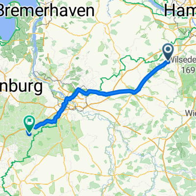
Osteradweg_gesamt
A cycling route starting in Tostedt, Lower Saxony, Germany.
Overview
About this route
Tour as part of the cycling program TSV Buxtehude-Altkloster from May 23 to 25, 2015
- -:--
- Duration
- 195.1 km
- Distance
- 62 m
- Ascent
- 123 m
- Descent
- ---
- Avg. speed
- ---
- Max. altitude

Route quality
Waytypes & surfaces along the route
Waytypes
Quiet road
89.7 km
(46 %)
Track
46.8 km
(24 %)
Surfaces
Paved
93.6 km
(48 %)
Unpaved
23.4 km
(12 %)
Asphalt
80 km
(41 %)
Paved (undefined)
13.7 km
(7 %)
Route highlights
Points of interest along the route
Point of interest after 64.6 km
Landfrauen-Café Eitzmühlen
Point of interest after 73.1 km
Gästehaus Sommergarten
Point of interest after 77.7 km
Gasthof Adebar
Point of interest after 102.4 km
Gedenkstätte Lager Sandbostel
Point of interest after 113.5 km
Eiscafé Venezia
Point of interest after 130.9 km
Plate's Osteblick
Point of interest after 131 km
Prahmfähre Gräpel
Point of interest after 137.4 km
Fähre Brobergen
Point of interest after 159.2 km
Schwebefähre Osten
Point of interest after 166.6 km
Ostekieker
Point of interest after 194.8 km
Pizzeria Da Bruno
Continue with Bikemap
Use, edit, or download this cycling route
You would like to ride Osteradweg_gesamt or customize it for your own trip? Here is what you can do with this Bikemap route:
Free features
- Save this route as favorite or in collections
- Copy & plan your own version of this route
- Split it into stages to create a multi-day tour
- Sync your route with Garmin or Wahoo
Premium features
Free trial for 3 days, or one-time payment. More about Bikemap Premium.
- Navigate this route on iOS & Android
- Export a GPX / KML file of this route
- Create your custom printout (try it for free)
- Download this route for offline navigation
Discover more Premium features.
Get Bikemap PremiumFrom our community
Other popular routes starting in Tostedt
 Brunsberg, Wassertunnel
- Distance
- 21.6 km
- Ascent
- 173 m
- Descent
- 174 m
- Location
- Tostedt, Lower Saxony, Germany
 Heiderunde
- Distance
- 58.8 km
- Ascent
- 331 m
- Descent
- 316 m
- Location
- Tostedt, Lower Saxony, Germany
 wilseder
- Distance
- 48.5 km
- Ascent
- 236 m
- Descent
- 235 m
- Location
- Tostedt, Lower Saxony, Germany
 Osteradweg_gesamt
- Distance
- 195.1 km
- Ascent
- 62 m
- Descent
- 123 m
- Location
- Tostedt, Lower Saxony, Germany
 TO - WH (HRO - BRU 3)
- Distance
- 122.4 km
- Ascent
- 278 m
- Descent
- 302 m
- Location
- Tostedt, Lower Saxony, Germany
 Oste Tour
- Distance
- 380.5 km
- Ascent
- 557 m
- Descent
- 616 m
- Location
- Tostedt, Lower Saxony, Germany
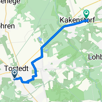 Triftstraße, Tostedt nach Weidenstraße, Kakenstorf
- Distance
- 7.8 km
- Ascent
- 28 m
- Descent
- 41 m
- Location
- Tostedt, Lower Saxony, Germany
 Tostedt - Zeven
- Distance
- 37.2 km
- Ascent
- 94 m
- Descent
- 130 m
- Location
- Tostedt, Lower Saxony, Germany
Open it in the app