Bad Elster - Tschechei - Bad Elster CLONED FROM ROUTE 876186
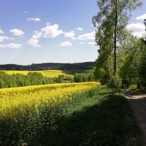
A cycling route starting in Bad Elster, Saxony, Germany.
Overview
About this route
None
(cloned from route 1150845)
- -:--
- Duration
- 25.2 km
- Distance
- 313 m
- Ascent
- 313 m
- Descent
- ---
- Avg. speed
- ---
- Avg. speed
Route quality
Waytypes & surfaces along the route
Waytypes
Road
9.9 km
(40 %)
Track
6.5 km
(26 %)
Surfaces
Paved
16.1 km
(64 %)
Unpaved
8.1 km
(32 %)
Asphalt
16.1 km
(64 %)
Gravel
6.4 km
(26 %)
Continue with Bikemap
Use, edit, or download this cycling route
You would like to ride Bad Elster - Tschechei - Bad Elster CLONED FROM ROUTE 876186 or customize it for your own trip? Here is what you can do with this Bikemap route:
Free features
- Save this route as favorite or in collections
- Copy & plan your own version of this route
- Sync your route with Garmin or Wahoo
Premium features
Free trial for 3 days, or one-time payment. More about Bikemap Premium.
- Navigate this route on iOS & Android
- Export a GPX / KML file of this route
- Create your custom printout (try it for free)
- Download this route for offline navigation
Discover more Premium features.
Get Bikemap PremiumFrom our community
Other popular routes starting in Bad Elster
- 2016_do_CP1
- Distance
- 464.2 km
- Ascent
- 2,749 m
- Descent
- 2,939 m
- Location
- Bad Elster, Saxony, Germany
- Heimweg Elsterradweg
- Distance
- 3.3 km
- Ascent
- 63 m
- Descent
- 59 m
- Location
- Bad Elster, Saxony, Germany
- Ringweg komplett Uhrzeigersinn
- Distance
- 22.4 km
- Ascent
- 679 m
- Descent
- 682 m
- Location
- Bad Elster, Saxony, Germany
- Trailtour an der Grenze
- Distance
- 34.7 km
- Ascent
- 547 m
- Descent
- 549 m
- Location
- Bad Elster, Saxony, Germany
- 2023_07 Studánka - Trojmezí pěšky
- Distance
- 9.4 km
- Ascent
- 95 m
- Descent
- 157 m
- Location
- Bad Elster, Saxony, Germany
- Elster - Hainberg
- Distance
- 10.4 km
- Ascent
- 405 m
- Descent
- 139 m
- Location
- Bad Elster, Saxony, Germany
- Bad Elster - Sohl - Remtengrün - Mühlhausen - Bad Elster
- Distance
- 19 km
- Ascent
- 423 m
- Descent
- 422 m
- Location
- Bad Elster, Saxony, Germany
- Alter Bahnhof
- Distance
- 12 km
- Ascent
- 323 m
- Descent
- 318 m
- Location
- Bad Elster, Saxony, Germany