Entspannende Route in
- 17.6 km
- 16 m
- 10 m
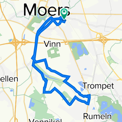
- Moers, North Rhine-Westphalia, Germany
A cycling route starting in Moers, North Rhine-Westphalia, Germany.
Overview
Start in the eastern part of Moers, then follow the Grafschafterradweg via Kapellen to Hülser Berg, over the hill to the Kapuzinerberg 'summit cross', continue past the Schluff Depot west of Hüls to Tönisberg, and return past the new GSV venue along the remaining section of the Grafschafterradweg back to the starting and finishing point.
created this 10 years ago
Route quality
Quiet road
18.1 km
(38 %)
Path
13.3 km
(28 %)
Paved
27.7 km
(58 %)
Unpaved
14.8 km
(31 %)
Asphalt
25.3 km
(53 %)
Gravel
5.7 km
(12 %)
Route highlights
Depot Schluff
Continue with Bikemap
You would like to ride Moers Ost-Hülserberg-Tönisberg Rundstrecke or customize it for your own trip? Here is what you can do with this Bikemap route:
Free trial for 3 days, or one-time payment. More about Bikemap Premium.
Discover more Premium features.
Get Bikemap PremiumFrom our community
Open it in the app