

alcantud-pozuelo por camino forestal
A cycling route starting in Alcantud, Castille-La Mancha, Spain.
Overview
About this route
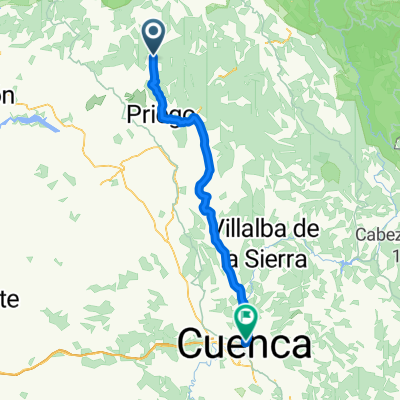
<p>This is a route connecting the Cuenca towns of Alcantud and El Pozuelo via forest trails.</p><p>It's 20 km of considerable difficulty but also spectacular beauty along the Toriles gorge.</p><p>On the way back, you have a good descent.</p><p>Recommended</p>
Translated, show original (Spanish)- -:--
- Duration
- 19.2 km
- Distance
- 571 m
- Ascent
- 184 m
- Descent
- ---
- Avg. speed
- 1,249 m
- Max. altitude
Route quality
Waytypes & surfaces along the route
Waytypes
Track
18.1 km
(94 %)
Road
0.6 km
(3 %)
Surfaces
Paved
0.8 km
(4 %)
Unpaved
18.1 km
(94 %)
Gravel
10 km
(52 %)
Loose gravel
8.1 km
(42 %)
Continue with Bikemap
Use, edit, or download this cycling route
You would like to ride alcantud-pozuelo por camino forestal or customize it for your own trip? Here is what you can do with this Bikemap route:
Free features
- Save this route as favorite or in collections
- Copy & plan your own version of this route
- Sync your route with Garmin or Wahoo
Premium features
Free trial for 3 days, or one-time payment. More about Bikemap Premium.
- Navigate this route on iOS & Android
- Export a GPX / KML file of this route
- Create your custom printout (try it for free)
- Download this route for offline navigation
Discover more Premium features.
Get Bikemap PremiumFrom our community
Other popular routes starting in Alcantud
 Alcantud - El Pozuelo
- Distance
- 12.8 km
- Ascent
- 473 m
- Descent
- 94 m
- Location
- Alcantud, Castille-La Mancha, Spain
 EL POZUELO, por Alcantud
- Distance
- 6.5 km
- Ascent
- 433 m
- Descent
- 36 m
- Location
- Alcantud, Castille-La Mancha, Spain
 alcantud-pozuelo por camino forestal
- Distance
- 19.2 km
- Ascent
- 571 m
- Descent
- 184 m
- Location
- Alcantud, Castille-La Mancha, Spain
 Peña del Aguila
- Distance
- 47.2 km
- Ascent
- 775 m
- Descent
- 775 m
- Location
- Alcantud, Castille-La Mancha, Spain
 SORTIDA ALCANTUD-CUENCA
- Distance
- 71.2 km
- Ascent
- 722 m
- Descent
- 614 m
- Location
- Alcantud, Castille-La Mancha, Spain
 cuenca - 3
- Distance
- 168.7 km
- Ascent
- 1,775 m
- Descent
- 1,737 m
- Location
- Alcantud, Castille-La Mancha, Spain
 76 Alcantud -Cuenca
- Distance
- 98.6 km
- Ascent
- 1,024 m
- Descent
- 866 m
- Location
- Alcantud, Castille-La Mancha, Spain
Open it in the app