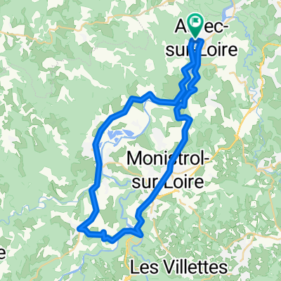
- 48.7 km
- 449 m
- 529 m
- Aurec-sur-Loire, Auvergne-Rhône-Alpes, France
gare d'aurec - basse en basset - monistrol - descente des sauvages
A cycling route starting in Aurec-sur-Loire, Auvergne-Rhône-Alpes, France.
Overview
About this route
A road circuit: about 35 km. Start and finish: Aurec station.
Follow the left bank of the Loire to Bas-en-Basset, climb to Monistrol* and descend
to Aurec via the superb Sauvages descent overlooking the river (right bank).
Note*: From Bas-en-Basset to Monistrol: cross the Loire; shortly after the bridge, on the climb, turn left
onto the small Les Salles road, then the path leading to the Bas TER station.
To return to Aurec station, climb back to Monistrol via the small Cheucle road and then the Pinet climb (elevation: 130 m).
Leaving Monistrol (Le Flachat), take the D47 to Aurec (nice descent).
- -:--
- Duration
- 33.6 km
- Distance
- 395 m
- Ascent
- 395 m
- Descent
- ---
- Avg. speed
- ---
- Max. altitude
Route quality
Waytypes & surfaces along the route
Waytypes
Quiet road
9.1 km
(27 %)
Road
2.7 km
(8 %)
Surfaces
Paved
8.4 km
(25 %)
Unpaved
0.7 km
(2 %)
Asphalt
8.4 km
(25 %)
Ground
0.7 km
(2 %)
Undefined
24.5 km
(73 %)
Continue with Bikemap
Use, edit, or download this cycling route
You would like to ride gare d'aurec - basse en basset - monistrol - descente des sauvages or customize it for your own trip? Here is what you can do with this Bikemap route:
Free features
- Save this route as favorite or in collections
- Copy & plan your own version of this route
- Sync your route with Garmin or Wahoo
Premium features
Free trial for 3 days, or one-time payment. More about Bikemap Premium.
- Navigate this route on iOS & Android
- Export a GPX / KML file of this route
- Create your custom printout (try it for free)
- Download this route for offline navigation
Discover more Premium features.
Get Bikemap PremiumFrom our community
Other popular routes starting in Aurec-sur-Loire
- L10: Aurec-sur-Loire - Montrond-les-Bains; 48,7km 340hm
- LV05 Aurec to Feurs.kml - LV05 Aurec to Feurs.kml_LV05 Aurec to Feurs
- 60.6 km
- 655 m
- 737 m
- Aurec-sur-Loire, Auvergne-Rhône-Alpes, France
- Aurec s Loire- Privas
- 187.4 km
- 4,177 m
- 4,317 m
- Aurec-sur-Loire, Auvergne-Rhône-Alpes, France
- L Ü: Rundtour Loire-Saone-Rhone-Via-Fluvia; 628km 3540hm
- 627.9 km
- 4,806 m
- 4,802 m
- Aurec-sur-Loire, Auvergne-Rhône-Alpes, France
- De Rue de la Rivière 30a, Aurec-sur-Loire à Rue de la Rivière 30a, Aurec-sur-Loire
- 41.5 km
- 1,671 m
- 1,655 m
- Aurec-sur-Loire, Auvergne-Rhône-Alpes, France
- 2023.2 Aurec s L - Parigny
- 105.4 km
- 1,017 m
- 1,132 m
- Aurec-sur-Loire, Auvergne-Rhône-Alpes, France
- Route nach Spanien 10 Tag
- 78.4 km
- 1,206 m
- 674 m
- Aurec-sur-Loire, Auvergne-Rhône-Alpes, France
- De Rue du Monument 3, Aurec-sur-Loire à Rue du Monument 3, Aurec-sur-Loire
- 111.5 km
- 4,442 m
- 4,442 m
- Aurec-sur-Loire, Auvergne-Rhône-Alpes, France
Open it in the app


