

Klöntal-Kaltbrunn (32.8km Rückweg)
A cycling route starting in Glarus, Canton of Glarus, Switzerland.
Overview
About this route
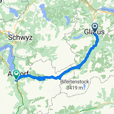
Return route from Klöntal Lake to Kaltbrunn
- -:--
- Duration
- 32.8 km
- Distance
- 26 m
- Ascent
- 454 m
- Descent
- ---
- Avg. speed
- ---
- Max. altitude

Route quality
Waytypes & surfaces along the route
Waytypes
Quiet road
8.8 km
(27 %)
Track
8.8 km
(27 %)
Surfaces
Paved
30.8 km
(94 %)
Unpaved
1 km
(3 %)
Asphalt
28.5 km
(87 %)
Paved (undefined)
2.3 km
(7 %)
Continue with Bikemap
Use, edit, or download this cycling route
You would like to ride Klöntal-Kaltbrunn (32.8km Rückweg) or customize it for your own trip? Here is what you can do with this Bikemap route:
Free features
- Save this route as favorite or in collections
- Copy & plan your own version of this route
- Sync your route with Garmin or Wahoo
Premium features
Free trial for 3 days, or one-time payment. More about Bikemap Premium.
- Navigate this route on iOS & Android
- Export a GPX / KML file of this route
- Create your custom printout (try it for free)
- Download this route for offline navigation
Discover more Premium features.
Get Bikemap PremiumFrom our community
Other popular routes starting in Glarus
 Sunntigstürli
- Distance
- 46.8 km
- Ascent
- 1,434 m
- Descent
- 1,420 m
- Location
- Glarus, Canton of Glarus, Switzerland
 Etappe-8
- Distance
- 137.8 km
- Ascent
- 2,721 m
- Descent
- 2,768 m
- Location
- Glarus, Canton of Glarus, Switzerland
 Klausen - Pragel - Rundfahrt
- Distance
- 130.9 km
- Ascent
- 2,716 m
- Descent
- 2,714 m
- Location
- Glarus, Canton of Glarus, Switzerland
 Transalp 2014 - T3
- Distance
- 74.9 km
- Ascent
- 2,094 m
- Descent
- 1,908 m
- Location
- Glarus, Canton of Glarus, Switzerland
 Pragelpass
- Distance
- 39.9 km
- Ascent
- 1,408 m
- Descent
- 1,461 m
- Location
- Glarus, Canton of Glarus, Switzerland
 Klöntal-Kaltbrunn (32.8km Rückweg)
- Distance
- 32.8 km
- Ascent
- 26 m
- Descent
- 454 m
- Location
- Glarus, Canton of Glarus, Switzerland
 Alpine Tour: Klontal -> Lehmen
- Distance
- 88.1 km
- Ascent
- 1,278 m
- Descent
- 1,179 m
- Location
- Glarus, Canton of Glarus, Switzerland
 V2_E02_ALPX_Schweiz
- Distance
- 65.7 km
- Ascent
- 2,338 m
- Descent
- 2,326 m
- Location
- Glarus, Canton of Glarus, Switzerland
Open it in the app