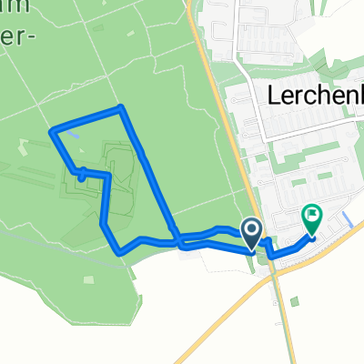
2015: Main-Kinzig
A cycling route starting in Ober-Olm, Rhineland-Palatinate, Germany.
Overview
About this route
Mainz-Schüchtern Bahn bis Gemünden/Main Gemünden - Klingenberg am Main Bahn bis Mainz
- -:--
- Duration
- 381.1 km
- Distance
- 730 m
- Ascent
- 730 m
- Descent
- ---
- Avg. speed
- 432 m
- Max. altitude
Route quality
Waytypes & surfaces along the route
Waytypes
Track
114.3 km
(30 %)
Quiet road
87.7 km
(23 %)
Surfaces
Paved
323.9 km
(85 %)
Unpaved
22.9 km
(6 %)
Asphalt
308.7 km
(81 %)
Gravel
15.2 km
(4 %)
Continue with Bikemap
Use, edit, or download this cycling route
You would like to ride 2015: Main-Kinzig or customize it for your own trip? Here is what you can do with this Bikemap route:
Free features
- Save this route as favorite or in collections
- Copy & plan your own version of this route
- Split it into stages to create a multi-day tour
- Sync your route with Garmin or Wahoo
Premium features
Free trial for 3 days, or one-time payment. More about Bikemap Premium.
- Navigate this route on iOS & Android
- Export a GPX / KML file of this route
- Create your custom printout (try it for free)
- Download this route for offline navigation
Discover more Premium features.
Get Bikemap PremiumFrom our community
Other popular routes starting in Ober-Olm
Laufrunde_klein1- Distance
- 4.1 km
- Ascent
- 132 m
- Descent
- 132 m
- Location
- Ober-Olm, Rhineland-Palatinate, Germany
Sackgäßchen 6, Ober-Olm nach Römerwall 62, Mainz- Distance
- 10.7 km
- Ascent
- 59 m
- Descent
- 155 m
- Location
- Ober-Olm, Rhineland-Palatinate, Germany
Flugplatz- Distance
- 13.4 km
- Ascent
- 85 m
- Descent
- 85 m
- Location
- Ober-Olm, Rhineland-Palatinate, Germany
Menzelstraße 16, Mainz nach Menzelstraße 16, Mainz- Distance
- 33.5 km
- Ascent
- 176 m
- Descent
- 234 m
- Location
- Ober-Olm, Rhineland-Palatinate, Germany
OO - Mainz - Nierstein - Wörrstadt - NO- Distance
- 61 km
- Ascent
- 243 m
- Descent
- 309 m
- Location
- Ober-Olm, Rhineland-Palatinate, Germany
Metzgerei Hardt Stadecken Elsheim- Distance
- 12.3 km
- Ascent
- 86 m
- Descent
- 166 m
- Location
- Ober-Olm, Rhineland-Palatinate, Germany
74 km Tour- Distance
- 74.1 km
- Ascent
- 346 m
- Descent
- 346 m
- Location
- Ober-Olm, Rhineland-Palatinate, Germany
Rheinhessen1- Distance
- 80.5 km
- Ascent
- 511 m
- Descent
- 527 m
- Location
- Ober-Olm, Rhineland-Palatinate, Germany
Open it in the app

