

projet des clochers mai 2013 (2)
A cycling route starting in Besançon, Bourgogne-Franche-Comté, France.
Overview
About this route
Miserey-Salines Auxon-Dessous Cussey-sur-l'Ognon (destroyed) Moncley Recologne Ruffey-le-Château Jallerange Etrabonne Mercey-le-Grand Lantenne-Vertière Ferrières-les-Bois Corcondray Lavernay Placey Audeux Mazerolles-le-Salin Pouilley-les-Vignes Serre-les-Sapins Pirey 19 bell towers
- -:--
- Duration
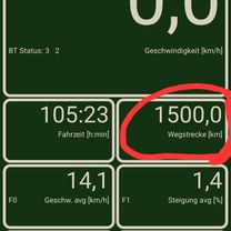
- 96.7 km
- Distance
- 493 m
- Ascent
- 504 m
- Descent
- ---
- Avg. speed
- ---
- Max. altitude

Route quality
Waytypes & surfaces along the route
Waytypes
Road
40.6 km
(42 %)
Quiet road
30 km
(31 %)
Surfaces
Paved
36.7 km
(38 %)
Asphalt
35.8 km
(37 %)
Paved (undefined)
1 km
(1 %)
Undefined
59.9 km
(62 %)
Continue with Bikemap
Use, edit, or download this cycling route
You would like to ride projet des clochers mai 2013 (2) or customize it for your own trip? Here is what you can do with this Bikemap route:
Free features
- Save this route as favorite or in collections
- Copy & plan your own version of this route
- Split it into stages to create a multi-day tour
- Sync your route with Garmin or Wahoo
Premium features
Free trial for 3 days, or one-time payment. More about Bikemap Premium.
- Navigate this route on iOS & Android
- Export a GPX / KML file of this route
- Create your custom printout (try it for free)
- Download this route for offline navigation
Discover more Premium features.
Get Bikemap PremiumFrom our community
Other popular routes starting in Besançon
 Trail des forts 19K sans la citadelle
- Distance
- 18.3 km
- Ascent
- 441 m
- Descent
- 441 m
- Location
- Besançon, Bourgogne-Franche-Comté, France
 Alpen2018_Etappe11__Besancon_Bessoncourt
- Distance
- 105.8 km
- Ascent
- 1,284 m
- Descent
- 1,163 m
- Location
- Besançon, Bourgogne-Franche-Comté, France
 Tout droit à l'intérieur Besançon
- Distance
- 17.2 km
- Ascent
- 161 m
- Descent
- 160 m
- Location
- Besançon, Bourgogne-Franche-Comté, France
 Deutschland - Portugal (Berlin - Faro) FR 10 Besançon - Orchamps
- Distance
- 44.2 km
- Ascent
- 306 m
- Descent
- 306 m
- Location
- Besançon, Bourgogne-Franche-Comté, France
 Besancon nach Mulhouse
- Distance
- 174.7 km
- Ascent
- 1,107 m
- Descent
- 1,131 m
- Location
- Besançon, Bourgogne-Franche-Comté, France
 Besancon - Chalon-sur-Saone
- Distance
- 136.4 km
- Ascent
- 607 m
- Descent
- 663 m
- Location
- Besançon, Bourgogne-Franche-Comté, France
 Besancon - Chalon-sur-Saone
- Distance
- 154.5 km
- Ascent
- 613 m
- Descent
- 675 m
- Location
- Besançon, Bourgogne-Franche-Comté, France
 VTT114
- Distance
- 27.2 km
- Ascent
- 498 m
- Descent
- 497 m
- Location
- Besançon, Bourgogne-Franche-Comté, France
Open it in the app