

Bonn - Remagen - Birresdorf - Godesberg - Bonn
A cycling route starting in Bonn, North Rhine-Westphalia, Germany.
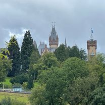
Overview
About this route
First along the Rhine and from Remagen, climb up to Birresdorf. Then descent to Godesberg and back to Bonn.
- -:--
- Duration
- 57.9 km
- Distance
- 520 m
- Ascent
- 519 m
- Descent
- ---
- Avg. speed
- ---
- Max. altitude
Route quality
Waytypes & surfaces along the route
Waytypes
Path
16.8 km
(29 %)
Quiet road
12.7 km
(22 %)
Surfaces
Paved
50.3 km
(87 %)
Unpaved
1.2 km
(2 %)
Asphalt
49.2 km
(85 %)
Paved (undefined)
1.2 km
(2 %)
Continue with Bikemap
Use, edit, or download this cycling route
You would like to ride Bonn - Remagen - Birresdorf - Godesberg - Bonn or customize it for your own trip? Here is what you can do with this Bikemap route:
Free features
- Save this route as favorite or in collections
- Copy & plan your own version of this route
- Sync your route with Garmin or Wahoo
Premium features
Free trial for 3 days, or one-time payment. More about Bikemap Premium.
- Navigate this route on iOS & Android
- Export a GPX / KML file of this route
- Create your custom printout (try it for free)
- Download this route for offline navigation
Discover more Premium features.
Get Bikemap PremiumFrom our community
Other popular routes starting in Bonn
 Siegtour
- Distance
- 44.5 km
- Ascent
- 173 m
- Descent
- 172 m
- Location
- Bonn, North Rhine-Westphalia, Germany
 Drachenfels-Milchhäuschen
- Distance
- 38.8 km
- Ascent
- 588 m
- Descent
- 585 m
- Location
- Bonn, North Rhine-Westphalia, Germany
 Von Troisdorf bis Köln und zurück
- Distance
- 70.2 km
- Ascent
- 231 m
- Descent
- 232 m
- Location
- Bonn, North Rhine-Westphalia, Germany
 Winterfeierabendrunde an die Sieg
- Distance
- 39.5 km
- Ascent
- 182 m
- Descent
- 182 m
- Location
- Bonn, North Rhine-Westphalia, Germany
 BRT2016-DI: Ins Drachenfelser Ländchen - PSF des Radsportbezirk Mittelrhein-Süd beim BRT 2016 in Bonn - 71 km Strecke
- Distance
- 72.5 km
- Ascent
- 609 m
- Descent
- 610 m
- Location
- Bonn, North Rhine-Westphalia, Germany
 Venusbergtour 02
- Distance
- 17.5 km
- Ascent
- 289 m
- Descent
- 280 m
- Location
- Bonn, North Rhine-Westphalia, Germany
 BRT2016-SA: westwärts.. - RTF des Radsportbezirk Mittelrhein-Süd beim BRT 2016 in Bonn - 100 km Strecke einer Super-Pfeil-Such-Fahrt
- Distance
- 100.8 km
- Ascent
- 222 m
- Descent
- 222 m
- Location
- Bonn, North Rhine-Westphalia, Germany
 Rund um Rheinbach und Todenfeld
- Distance
- 69.1 km
- Ascent
- 570 m
- Descent
- 530 m
- Location
- Bonn, North Rhine-Westphalia, Germany
Open it in the app