

Col du Sabot
A cycling route starting in Huez, Auvergne-Rhône-Alpes, France.
Overview
About this route
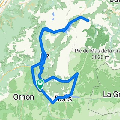
Lesser-known pass in the Oisans. Very quiet and little frequented. The asphalt becomes very gravelly towards the end, but with care you can climb and descend without putting your foot down. From the pass, you can see the lake leading to the Col du Glandon.
- -:--
- Duration
- 38.8 km
- Distance
- 1,445 m
- Ascent
- 1,443 m
- Descent
- ---
- Avg. speed
- ---
- Max. altitude

Route quality
Waytypes & surfaces along the route
Waytypes
Quiet road
15.5 km
(40 %)
Road
1.2 km
(3 %)
Undefined
22.1 km
(57 %)
Surfaces
Paved
36.9 km
(95 %)
Asphalt
36.9 km
(95 %)
Undefined
1.9 km
(5 %)
Continue with Bikemap
Use, edit, or download this cycling route
You would like to ride Col du Sabot or customize it for your own trip? Here is what you can do with this Bikemap route:
Free features
- Save this route as favorite or in collections
- Copy & plan your own version of this route
- Sync your route with Garmin or Wahoo
Premium features
Free trial for 3 days, or one-time payment. More about Bikemap Premium.
- Navigate this route on iOS & Android
- Export a GPX / KML file of this route
- Create your custom printout (try it for free)
- Download this route for offline navigation
Discover more Premium features.
Get Bikemap PremiumFrom our community
Other popular routes starting in Huez
 Bourg d'Oisans - Bourg d'Oisans
- Distance
- 159.7 km
- Ascent
- 4,577 m
- Descent
- 3,464 m
- Location
- Huez, Auvergne-Rhône-Alpes, France
 Alpe d`Huez
- Distance
- 14.2 km
- Ascent
- 1,183 m
- Descent
- 70 m
- Location
- Huez, Auvergne-Rhône-Alpes, France
 L'Alpe d'Huez
- Distance
- 60.3 km
- Ascent
- 1,850 m
- Descent
- 1,850 m
- Location
- Huez, Auvergne-Rhône-Alpes, France
 L'Alpe-d-Huez
- Distance
- 12.9 km
- Ascent
- 1,222 m
- Descent
- 94 m
- Location
- Huez, Auvergne-Rhône-Alpes, France
 Glandon - Croix de Fer
- Distance
- 65.5 km
- Ascent
- 1,611 m
- Descent
- 1,611 m
- Location
- Huez, Auvergne-Rhône-Alpes, France
 Classic Climbs - Day 1b - Col Du Galibier
- Distance
- 47.2 km
- Ascent
- 2,437 m
- Descent
- 550 m
- Location
- Huez, Auvergne-Rhône-Alpes, France
 Glandon/Croix de Fer - Alpe d'Huez - Sarenne
- Distance
- 122.4 km
- Ascent
- 2,642 m
- Descent
- 2,643 m
- Location
- Huez, Auvergne-Rhône-Alpes, France
 Tour du plateau matheysin par laffrey
- Distance
- 97.9 km
- Ascent
- 1,505 m
- Descent
- 1,505 m
- Location
- Huez, Auvergne-Rhône-Alpes, France
Open it in the app