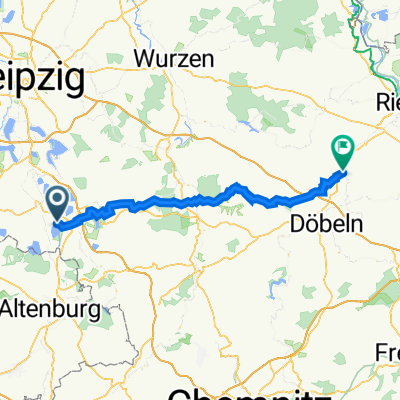
9-Seen-Umrundung
A cycling route starting in Deutzen, Saxony, Germany.
Overview
About this route
Deutzen, Neukieritzsch, Kahnsdorfer Lake, Espenhain, Störmthaler Lake (west shore), Markkleeberger Lake (clockwise), Störmthaler Lake (east shore), Dreiskau-Muckern, Mölbis, Trages, Braußwig, Dittmannsdorf, Bockwitzer Lake, Nenkersdorf, Harthsee Lake, Neukirchen, Wyhra, Thräna, Regis-Breitingen
- -:--
- Duration
- 76.5 km
- Distance
- 186 m
- Ascent
- 186 m
- Descent
- ---
- Avg. speed
- ---
- Max. altitude
Route quality
Waytypes & surfaces along the route
Waytypes
Track
27.5 km
(36 %)
Quiet road
13.8 km
(18 %)
Surfaces
Paved
61.2 km
(80 %)
Unpaved
2.3 km
(3 %)
Asphalt
61.2 km
(80 %)
Gravel
2.3 km
(3 %)
Undefined
13 km
(17 %)
Continue with Bikemap
Use, edit, or download this cycling route
You would like to ride 9-Seen-Umrundung or customize it for your own trip? Here is what you can do with this Bikemap route:
Free features
- Save this route as favorite or in collections
- Copy & plan your own version of this route
- Sync your route with Garmin or Wahoo
Premium features
Free trial for 3 days, or one-time payment. More about Bikemap Premium.
- Navigate this route on iOS & Android
- Export a GPX / KML file of this route
- Create your custom printout (try it for free)
- Download this route for offline navigation
Discover more Premium features.
Get Bikemap PremiumFrom our community
Other popular routes starting in Deutzen
 Neuseenland zwischen Deutzen und Rötha
- Distance
- 61.2 km
- Ascent
- 176 m
- Descent
- 176 m
- Location
- Deutzen, Saxony, Germany
 Meuselwitz-Pölzig-Windischleuba
- Distance
- 96.8 km
- Ascent
- 295 m
- Descent
- 296 m
- Location
- Deutzen, Saxony, Germany
 Runde um die Adria leichtes Gelände u. Feld
- Distance
- 12 km
- Ascent
- 53 m
- Descent
- 56 m
- Location
- Deutzen, Saxony, Germany
 Adria Runde kurz
- Distance
- 9.4 km
- Ascent
- 29 m
- Descent
- 29 m
- Location
- Deutzen, Saxony, Germany
 9 HeimatTour GPX3_Garmin
- Distance
- 63.5 km
- Ascent
- 424 m
- Descent
- 431 m
- Location
- Deutzen, Saxony, Germany
 Meuselwitz-Ronneburg-Starkenberg
- Distance
- 99.8 km
- Ascent
- 352 m
- Descent
- 352 m
- Location
- Deutzen, Saxony, Germany
 Hainer See zum Tagebauausichtspunkt
- Distance
- 8.7 km
- Ascent
- 9 m
- Descent
- 28 m
- Location
- Deutzen, Saxony, Germany
 Drogen-Tour
- Distance
- 96 km
- Ascent
- 359 m
- Descent
- 359 m
- Location
- Deutzen, Saxony, Germany
Open it in the app

