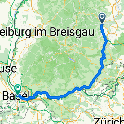
Bräunlingen nach Maulbeerstrasse, Basel
- 140.1 km
- 1,218 m
- 1,662 m
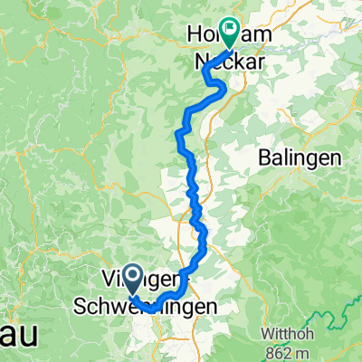
- Villingen-Schwenningen, Baden-Wurttemberg, Germany
A cycling route starting in Villingen-Schwenningen, Baden-Wurttemberg, Germany.
Overview
TEASI track
created this 10 years ago
Route quality
Track
7.4 km
(74 %)
Quiet road
2 km
(20 %)
Paved
2.2 km
(22 %)
Unpaved
7.2 km
(72 %)
Loose gravel
6 km
(60 %)
Asphalt
2 km
(20 %)
Continue with Bikemap
You would like to ride Von Brunnenstraße 31, 78050 Villingen-Schwenningen nach Pfeifferlochsee or customize it for your own trip? Here is what you can do with this Bikemap route:
Free trial for 3 days, or one-time payment. More about Bikemap Premium.
Discover more Premium features.
Get Bikemap PremiumFrom our community
Open it in the app