

MTB zum Hermannsdenkmal und Externsteine
A cycling route starting in Oerlinghausen, North Rhine-Westphalia, Germany.
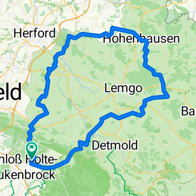
Overview
About this route
Easy MTB tour from Schloß Holte to the Hermannsdenkmal - Approach on asphalt, from the glider airfield on gravel and through the forest - Descent from the Hermannsdenkmal via the road to the lower car park. On the way out, you pass the forest pub 'Bienenschmidt'; in summer, ride the route in reverse and finish with a cold wheat beer ('Hefe') ;-) (cloned from route 123819)
- -:--
- Duration
- 52.6 km
- Distance
- 899 m
- Ascent
- 899 m
- Descent
- ---
- Avg. speed
- ---
- Max. altitude
Route quality
Waytypes & surfaces along the route
Waytypes
Track
31.1 km
(59 %)
Path
7.9 km
(15 %)
Surfaces
Paved
13.7 km
(26 %)
Unpaved
36.8 km
(70 %)
Gravel
28.4 km
(54 %)
Asphalt
13.7 km
(26 %)
Route highlights
Points of interest along the route
Point of interest after 6.2 km
Bienenschmidt
Point of interest after 25.8 km
Externsteine
Point of interest after 33.6 km
Hermannsdenkmal
Continue with Bikemap
Use, edit, or download this cycling route
You would like to ride MTB zum Hermannsdenkmal und Externsteine or customize it for your own trip? Here is what you can do with this Bikemap route:
Free features
- Save this route as favorite or in collections
- Copy & plan your own version of this route
- Sync your route with Garmin or Wahoo
Premium features
Free trial for 3 days, or one-time payment. More about Bikemap Premium.
- Navigate this route on iOS & Android
- Export a GPX / KML file of this route
- Create your custom printout (try it for free)
- Download this route for offline navigation
Discover more Premium features.
Get Bikemap PremiumFrom our community
Other popular routes starting in Oerlinghausen
 133 Köterberg
- Distance
- 136 km
- Ascent
- 635 m
- Descent
- 636 m
- Location
- Oerlinghausen, North Rhine-Westphalia, Germany
 Sennestadt - Gütersloh
- Distance
- 47.5 km
- Ascent
- 1,213 m
- Descent
- 1,207 m
- Location
- Oerlinghausen, North Rhine-Westphalia, Germany
 Oerlinghausen Radfahren
- Distance
- 54.1 km
- Ascent
- 82 m
- Descent
- 82 m
- Location
- Oerlinghausen, North Rhine-Westphalia, Germany
 Oerlinghausen Radfahren
- Distance
- 32.7 km
- Ascent
- 298 m
- Descent
- 295 m
- Location
- Oerlinghausen, North Rhine-Westphalia, Germany
 Oh,wie schön ist OWL
- Distance
- 98.6 km
- Ascent
- 705 m
- Descent
- 704 m
- Location
- Oerlinghausen, North Rhine-Westphalia, Germany
 Flachetappe
- Distance
- 69.7 km
- Ascent
- 104 m
- Descent
- 126 m
- Location
- Oerlinghausen, North Rhine-Westphalia, Germany
 MTB zum Hermannsdenkmal und Externsteine
- Distance
- 52.6 km
- Ascent
- 899 m
- Descent
- 899 m
- Location
- Oerlinghausen, North Rhine-Westphalia, Germany
 Spred Out Donnerstag Course In Bielefeld
- Distance
- 8 km
- Ascent
- 17 m
- Descent
- 16 m
- Location
- Oerlinghausen, North Rhine-Westphalia, Germany
Open it in the app