

PMC 2008 Day 1 Pt 2
A cycling route starting in Rehoboth, Massachusetts, United States.
Overview
About this route
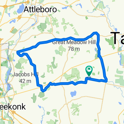
Pan-Mass Challenge (PMC), Day 1, Sturbridge to Bourne, Part 2: from waterstop #3 to finish.
This route was entered in two parts because the whole route is too complex for the BikeMap.net mapping tool.
- -:--
- Duration
- 64.2 km
- Distance
- 219 m
- Ascent
- 237 m
- Descent
- ---
- Avg. speed
- 26 m
- Max. altitude
Route quality
Waytypes & surfaces along the route
Waytypes
Busy road
25.1 km
(39 %)
Quiet road
20 km
(31 %)
Surfaces
Paved
27.3 km
(42 %)
Unpaved
0.4 km
(<1 %)
Asphalt
27.1 km
(42 %)
Unpaved (undefined)
0.4 km
(<1 %)
Route highlights
Points of interest along the route
Point of interest after 0.4 km
Waterstop #3, Dighton/Reheboth Regional High School
Point of interest after 23.1 km
Waterstop #4, Apponequet Regional High School, Lakeville, MA
Point of interest after 49.5 km
Waterstop #5, Decas Elementary School, Wareham, MA
Continue with Bikemap
Use, edit, or download this cycling route
You would like to ride PMC 2008 Day 1 Pt 2 or customize it for your own trip? Here is what you can do with this Bikemap route:
Free features
- Save this route as favorite or in collections
- Copy & plan your own version of this route
- Sync your route with Garmin or Wahoo
Premium features
Free trial for 3 days, or one-time payment. More about Bikemap Premium.
- Navigate this route on iOS & Android
- Export a GPX / KML file of this route
- Create your custom printout (try it for free)
- Download this route for offline navigation
Discover more Premium features.
Get Bikemap PremiumFrom our community
Other popular routes starting in Rehoboth
 26 Palmer Meadow Ln, Rehoboth to 26 Palmer Meadow Ln, Rehoboth
- Distance
- 3.6 km
- Ascent
- 30 m
- Descent
- 30 m
- Location
- Rehoboth, Massachusetts, United States
 26 mile loop
- Distance
- 41.6 km
- Ascent
- 130 m
- Descent
- 125 m
- Location
- Rehoboth, Massachusetts, United States
 pmc route
- Distance
- 53.8 km
- Ascent
- 178 m
- Descent
- 182 m
- Location
- Rehoboth, Massachusetts, United States
 Recovered Route
- Distance
- 36.4 km
- Ascent
- 246 m
- Descent
- 285 m
- Location
- Rehoboth, Massachusetts, United States
 Recovered Route
- Distance
- 28.4 km
- Ascent
- 151 m
- Descent
- 148 m
- Location
- Rehoboth, Massachusetts, United States
 PMC 2008 Day 1 Pt 2
- Distance
- 64.2 km
- Ascent
- 219 m
- Descent
- 237 m
- Location
- Rehoboth, Massachusetts, United States
 quick 10
- Distance
- 15.8 km
- Ascent
- 85 m
- Descent
- 84 m
- Location
- Rehoboth, Massachusetts, United States
 30 mile
- Distance
- 47 km
- Ascent
- 181 m
- Descent
- 171 m
- Location
- Rehoboth, Massachusetts, United States
Open it in the app