

Etzelkofen - Grafenried "Bise"
A cycling route starting in Bern, Canton of Bern, Switzerland.
Overview
About this route
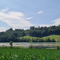
Trainigsrunde, starke Bise
Im wald zwischen Etzelkofen und Grafenried Mergelpiste statt Asphalt!- -:--
- Duration
- 41.8 km
- Distance
- 242 m
- Ascent
- 242 m
- Descent
- ---
- Avg. speed
- ---
- Max. altitude
Route quality
Waytypes & surfaces along the route
Waytypes
Quiet road
12.6 km
(30 %)
Road
6.7 km
(16 %)
Surfaces
Paved
34.3 km
(82 %)
Unpaved
2.9 km
(7 %)
Asphalt
33.5 km
(80 %)
Gravel
1.7 km
(4 %)
Continue with Bikemap
Use, edit, or download this cycling route
You would like to ride Etzelkofen - Grafenried "Bise" or customize it for your own trip? Here is what you can do with this Bikemap route:
Free features
- Save this route as favorite or in collections
- Copy & plan your own version of this route
- Sync your route with Garmin or Wahoo
Premium features
Free trial for 3 days, or one-time payment. More about Bikemap Premium.
- Navigate this route on iOS & Android
- Export a GPX / KML file of this route
- Create your custom printout (try it for free)
- Download this route for offline navigation
Discover more Premium features.
Get Bikemap PremiumFrom our community
Other popular routes starting in Bern
 Bern-Murtesee-Wohlesee-Rundi
- Distance
- 86.9 km
- Ascent
- 588 m
- Descent
- 630 m
- Location
- Bern, Canton of Bern, Switzerland
 Bärenplatz Wohlei Zollikofen
- Distance
- 17.9 km
- Ascent
- 429 m
- Descent
- 453 m
- Location
- Bern, Canton of Bern, Switzerland
 Ume Brambärg
- Distance
- 47.3 km
- Ascent
- 349 m
- Descent
- 350 m
- Location
- Bern, Canton of Bern, Switzerland
 Wohlesee churz
- Distance
- 40.1 km
- Ascent
- 217 m
- Descent
- 263 m
- Location
- Bern, Canton of Bern, Switzerland
 Wahlerechiuchli obedüre
- Distance
- 45.1 km
- Ascent
- 453 m
- Descent
- 507 m
- Location
- Bern, Canton of Bern, Switzerland
 Bern Köniztal Gelterfingen Bern
- Distance
- 35 km
- Ascent
- 263 m
- Descent
- 264 m
- Location
- Bern, Canton of Bern, Switzerland
 Aare-Fyrabe-Loop
- Distance
- 14.7 km
- Ascent
- 263 m
- Descent
- 264 m
- Location
- Bern, Canton of Bern, Switzerland
 128.151 Thunersee via Heiligenschwendi
- Distance
- 128.1 km
- Ascent
- 1,248 m
- Descent
- 1,248 m
- Location
- Bern, Canton of Bern, Switzerland
Open it in the app